
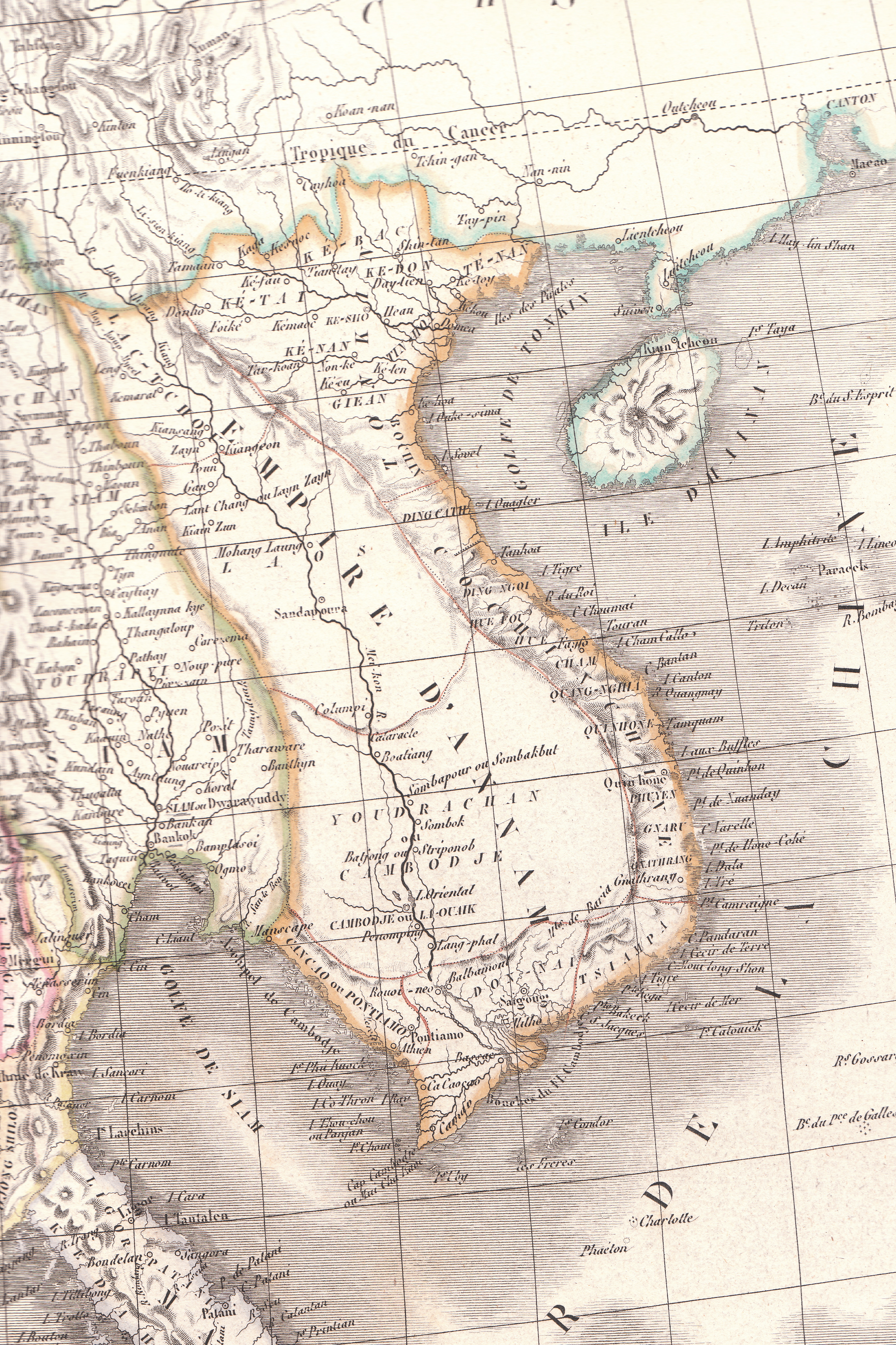
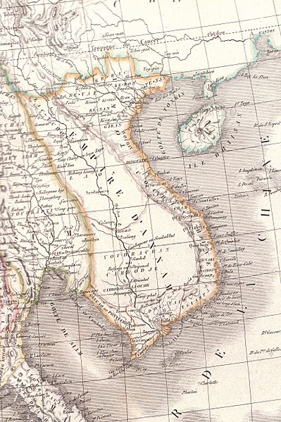
Image: Map of Vietnam 1829
Size of this preview: 399 × 599 pixels. Other resolutions: 160 × 240 pixels | 3,464 × 5,200 pixels.
Original image (3,464 × 5,200 pixels, file size: 8.83 MB, MIME type: image/jpeg)
Description: Plate 35E "Carte de l’Inde endeca et audela du Gange" from Lapie's Atlas Universel printed in 1829
Title: Map of Vietnam 1829
Credit: Atlas Universel
Author: Pierre M. Lapie
Usage Terms: Public domain
License: Public domain
Attribution Required?: No
Image usage
The following 3 pages link to this image:

All content from Kiddle encyclopedia articles (including the article images and facts) can be freely used under Attribution-ShareAlike license, unless stated otherwise.