
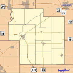
Image: Location map of Carroll County, Indiana

Size of this PNG preview of this SVG file: 600 × 600 pixels. Other resolution: 240 × 240 pixels.
Original image (SVG file, nominally 768 × 768 pixels, file size: 201 KB)
Description: This is a map of Carroll County, Indiana, USA which includes incorporated settlements, township borders, and major highways.
Title: Location map of Carroll County, Indiana
Credit: My own work, using custom-written MapScript applications with United States Census Bureau data
Author: Omnedon
Usage Terms: Public domain
License: Public domain
Attribution Required?: No
Image usage
The following 17 pages link to this image:
- Bringhurst, Indiana
- Burrows, Indiana
- Carrollton, Carroll County, Indiana
- Cutler, Indiana
- Delphi Courthouse Square Historic District
- Lexington, Carroll County, Indiana
- Lockport, Indiana
- Ockley, Indiana
- Owasco, Indiana
- Patton, Indiana
- Pittsburg, Indiana
- Prince William, Indiana
- Pulaski County Bridge No. 31
- Pyrmont, Indiana
- Radnor, Indiana
- Rockfield, Indiana
- Wheeling, Carroll County, Indiana

All content from Kiddle encyclopedia articles (including the article images and facts) can be freely used under Attribution-ShareAlike license, unless stated otherwise.