
Image: Gilarivermap
No higher resolution available.
Gilarivermap.png (499 × 500 pixels, file size: 382 KB, MIME type: image/png)
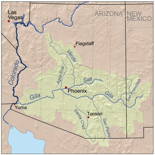
Description: Map of the Gila River watershed-drainage basin — located in New Mexico and Arizona. Showing Gila Basin tributaries of the Colorado River.
Title: Gilarivermap
Credit: Self-made, based on USGS data.
Author: Kmusser
Usage Terms: Creative Commons Attribution-Share Alike 2.5
License: CC BY-SA 2.5
License Link: http://creativecommons.org/licenses/by-sa/2.5
Attribution Required?: Yes
Image usage
The following 11 pages link to this image:

All content from Kiddle encyclopedia articles (including the article images and facts) can be freely used under Attribution-ShareAlike license, unless stated otherwise.