Gunsight Mountain (Montana) facts for kids
Quick facts for kids Gunsight Mountain |
|
|---|---|

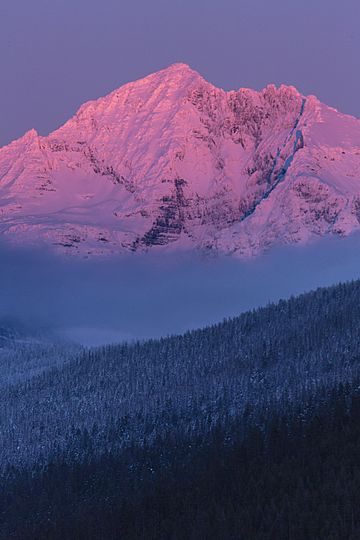
Gunsight Mountain at sunset
|
|
| Highest point | |
| Elevation | 9,263 ft (2,823 m) |
| Prominence | 2,312 ft (705 m) |
| Geography | |
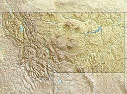
| Location | Flathead County, Montana, United States |
| Parent range | Lewis Range |
| Topo map | USGS Lake McDonald East |
| Climbing | |
| First ascent | Lyman Sperry (1905) |
Gunsight Mountain (9,263 feet (2,823 m)) is located in the Lewis Range, Glacier National Park in the U.S. state of Montana. Gunsight Mountain is named after the adjacent Gunsight Pass, which was named by George Bird Grinnell in 1891.
Geology
Like other mountains in Glacier National Park, Gunsight Mountain is composed of sedimentary rock laid down during the Precambrian to Jurassic periods. Formed in shallow seas, this sedimentary rock was initially uplifted beginning 170 million years ago when the Lewis Overthrust fault pushed an enormous slab of precambrian rocks 3 mi (4.8 km) thick, 50 miles (80 km) wide and 160 miles (260 km) long over younger rock of the cretaceous period.

All content from Kiddle encyclopedia articles (including the article images and facts) can be freely used under Attribution-ShareAlike license, unless stated otherwise. Cite this article:
Gunsight Mountain (Montana) Facts for Kids. Kiddle Encyclopedia.


