Glabbeek facts for kids
Quick facts for kids
Glabbeek
|
|||
|---|---|---|---|
 |
|||
|
|||
| Country | Belgium | ||
| Community | Flemish Community | ||
| Region | Flemish Region | ||
| Province | Flemish Brabant | ||
| Arrondissement | Leuven | ||
| Area | |||
| • Total | 26.78 km2 (10.34 sq mi) | ||
| Population
(2018-01-01)Lua error in Module:Wd at line 1575: attempt to index field 'wikibase' (a nil value).
|
|||
| • Total | Lua error in Module:Wd at line 1,575: attempt to index field 'wikibase' (a nil value). | ||
| Postal codes |
3380, 3381, 3384
|
||
| Area codes | 016 | ||
| Website | www.glabbeek.be | ||
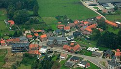
Glabbeek (Dutch pronunciation: [ˈɣlɑbeːk]) is a municipality located in the Belgian province of Flemish Brabant. The municipality comprises the towns of Attenrode, Bunsbeek, Glabbeek proper, Kapellen, Wever and Zuurbemde. On January 1, 2006, Glabbeek had a total population of 5,189. The total area is 26.78 km2 which gives a population density of 194 inhabitants per km2.
See also
 In Spanish: Glabbeek para niños

All content from Kiddle encyclopedia articles (including the article images and facts) can be freely used under Attribution-ShareAlike license, unless stated otherwise. Cite this article:
Glabbeek Facts for Kids. Kiddle Encyclopedia.


