Geography of North Carolina facts for kids
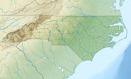
The geography of North Carolina falls naturally into three divisions:
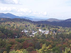
- the Appalachian Mountains in the west (including the Blue Ridge and Great Smoky Mountains),
- the central Piedmont Plateau, and
- the eastern Atlantic Coastal Plain.
North Carolina covers 53,821 square miles (139,396 km2) and is 503 miles (810 km) long by 150 miles (241 km) wide. The physical characteristics of the state vary from the summits of the Smoky Mountains, an altitude of near seven thousand feet (2,130 m) in the west, to the beaches of the Atlantic Ocean at sea level in the east.
Contents
Blue Ridge/Appalachian Mountains
The mountains of North Carolina may be conveniently classed as four separate chains:
- The Great Smoky Mountains are also called the "Smokies."
- The Blue Ridge Mountains is North Carolina's largest mountain range and contains some of the highest mountains in the Eastern United States. The Black Mountains, a subrange of the Blue Ridge Mountains. Mount Mitchell, part of the Black Mountains, at 6,684 feet (2,037.3 m) above sea level, is the highest peak east of the Mississippi River.
- The Brushy Mountains is a smaller and lower mountain range, located only in North Carolina.
- The Uwharrie Mountains are North Carolina's easternmost mountain range. It is named after a Native American tribe which once lived in the region.
Piedmont Plateau
The Piedmont plateau forms the central third of the state. It contains the state's largest cities. Major cities like Charlotte and Raleigh are expanding further and further from the city's centers, with more people moving into the newly developed areas.
Elevations range from about 300 feet to 1,100 feet above sea level. There are a few mountains, mainly on the western side of the region. The Piedmont lies within the Southeastern mixed forests ecoregion and has many forests.
Tobacco is an important resource throughout the Piedmont. The original inhabitants of the Piedmont were the Catawba people. Europeans started settling in this region around the 1700s.
Coastal Plain
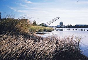
The Coastal Plain is the largest land area of the state. It covers about 45% of North Carolina. It begins along the fall line, where the Piedmont Plateau drops and waterfalls begin to appear on streams and rivers in the state. East of the fall line the coastal plain is relatively flat, with sandy soils ideal for growing tobacco, cotton, soybeans, and melons. The rivers of the coastal plain are much wider and deeper than those of the Piedmont or mountains and flow more slowly.
North Carolina never developed a major port city because it does not contain a natural harbor. Much of the beachfront contains the Outer Banks, sandy islands that do not have coral reefs to attach to and thus are constantly shifting their locations. The Outer Banks are known as the "Graveyard of the Atlantic" because numerous ships have been wrecked along their beaches and shoals due to storms and strong tides.
The Coastal Plain has three capes: Cape Hatteras, Cape Lookout, and Cape Fear. The Cape Fear River often has to be dredged so large ships can sail on it.
Agriculture
The Mountain section grows sweet corn, wheat, oats, barley, hay, tobacco, fruits and vegetables, and more recently, Christmas Trees. Cattle and chickens are raised for market.
The same products are grown and raised in the Piedmont region. Cotton is plentiful over its southern half. Longleaf pine forests used to produce tar, pitch, and turpentine. They have been replaced with loblolly pine, which is used for paper pulp, plywood, and lumber.
Four of the grape varieties of America are native to North Carolina; the Catawba, Isabella, Lincoln, and Scuppernong.
River systems
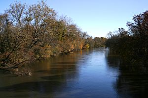
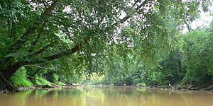
Seventeen major river basins cover North Carolina. They can be divided into three groups.
- In the very west part of North Carolina, some rivers flow in a northwesterly direction. They flow into the Mississippi River, which drains into the Gulf of Mexico.
- In central North Carolina, rivers flow generally southward toward South Carolina before draining into the Altantic Ocean.
- In eastern North Carolina, most of the rivers flow eastward or southeastward. They empty into one of the sounds that separate the mainland of North Carolina from the Outer Banks. (A sound is a small body of water that comes in from the ocean.)
The divide between the Atlantic and Gulf watersheds, part of a larger divide known as the Eastern Continental Divide, lies along the Blue Ridge Mountains. The eastern side of the divide runs into the Atlantic Ocean, while the western side runs into the Gulf of Mexico through the Mississippi River.
See also:
Lakes
Large, natural lakes are rare, except for the elliptically shaped lakes or ponds in the eastern part of the state that are referred to as Carolina bays. North Carolina is home to many large reservoirs along its major river systems. Many of these reservoirs serve as water supplies for North Carolina's urban areas but also have recreational areas including boat ramps, fishing areas, and beaches.
Climate
North Carolina's location, midway in the Northern Hemisphere, is why its climate is humid, warm, and stable. Most of the state is located east of the Appalachian chain, which shields it from the cold winter winds of the northwest. The warm Gulf Stream current near the shores help the ocean side stay warmer during winter.
| Cities | Jan | Feb | Mar | Apr | May | Jun | Jul | Aug | Sep | Oct | Nov | Dec |
|---|---|---|---|---|---|---|---|---|---|---|---|---|
| Asheville | 46/26 | 50/28 | 58/35 | 66/42 | 74/51 | 80/58 | 83/63 | 82/62 | 76/55 | 67/43 | 57/35 | 49/29 |
| Cape Hatteras | 54/39 | 55/39 | 60/44 | 68/52 | 75/60 | 82/68 | 85/73 | 85/72 | 81/68 | 73/59 | 65/50 | 57/43 |
| Charlotte | 51/32 | 56/34 | 64/42 | 73/49 | 80/58 | 87/66 | 90/71 | 88/69 | 82/63 | 73/51 | 63/42 | 54/35 |
| Greensboro | 47/28 | 52/31 | 60/38 | 70/46 | 77/55 | 84/64 | 88/68 | 86/67 | 79/60 | 70/48 | 60/39 | 51/31 |
| Raleigh | 50/30 | 54/32 | 62/39 | 72/46 | 79/55 | 86/64 | 89/68 | 87/67 | 81/61 | 72/48 | 62/40 | 53/33 |
| Wilmington | 56/36 | 60/38 | 66/44 | 74/51 | 81/60 | 86/68 | 90/72 | 88/71 | 84/66 | 76/54 | 68/45 | 60/38 |
Interesting facts about the geography of North Carolina
- Fog appears often, especially during the summer.
- Frosts do not happen until mid-October on the ocean side of North Carolina.
- Ice forms on surfaces at least once per winter on the ocean side and more often in the mountains.
- Snows are usually light and only remain on the ground for a few days except in higher elevations.
- North Carolina averages 5 inches (130 mm) of snow per winter season.
- The average rainfall is about fifty-three inches per year.
- North Carolina is the 14th wettest state by precipitation (rain and snow) in the United States.
- The warmest temperature ever recorded in North Carolina was 110 °F on August 21st, 1983.
- The coldest temperature ever recorded in North Carolina was -34 °F on January 21st, 1985.
- Average temperatures in the summer are near 80 °F.
- Average temperatures in the winter are near 50 °F.
Images for kids


