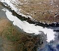
Fog facts for kids
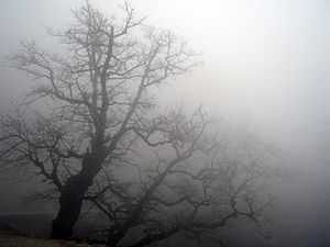
Fog is mist when it is very thick. It may appear on land or sea. It usually lowers visibility (makes it hard to see very far). When fog forms at high levels it creates a cloud called stratus. When the air chills, moisture will turn to fog.
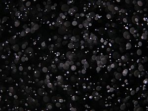
Fog is made up of tiny water droplets or, in very cold conditions, ice crystals. When seen on a high speed camera, (a special camera that takes many frames and can view videos at very low speed) it looks like hundreds of small water droplets moving through the air. These water droplets make up the fog or mist. There are many types of fog, such as evaporation fog, advection fog, radiation fog, and upslope fog. The thickness of fog varies depending on the atmosphere, temperature, weather and location.
-
The morning fog in the Rhine Valley between Lienz / Altstätten and Rüthi.
-
Ground fog in East Frisia (Moordorf)
Contents
Formation
Fog forms when the difference between air temperature and dew point is less than 2.5 °C or 4 °F.
Fog begins to form when water vapor condenses into tiny liquid water droplets suspended in the air. Six examples of ways that water vapor is added to the air are by wind convergence into areas of upward motion; precipitation or virga falling from above; daytime heating evaporating water from the surface of oceans, water bodies, or wet land; transpiration from plants; cool or dry air moving over warmer water; and lifting air over mountains. Water vapor normally begins to condense on condensation nuclei such as dust, ice, and salt in order to form clouds. Fog, like its elevated cousin stratus, is a stable cloud deck which tends to form when a cool, stable air mass is trapped underneath a warm air mass.
Fog normally occurs at a relative humidity near 100%. This occurs from either added moisture in the air, or falling ambient air temperature. However, fog can form at lower humidities, and can sometimes fail to form with relative humidity at 100%. At 100% relative humidity, the air cannot hold additional moisture, thus, the air will become supersaturated if additional moisture is added.
Fog can form suddenly and can dissipate just as rapidly. The sudden formation of fog is known as "flash fog".
Fog commonly produces precipitation in the form of drizzle or very light snow. Drizzle occurs when the humidity of fog attains 100% and the minute cloud droplets begin to coalesce into larger droplets. This can occur when the fog layer is lifted and cooled sufficiently, or when it is forcibly compressed from above by descending air. Drizzle becomes freezing drizzle when the temperature at the surface drops below the freezing point.
The thickness of a fog layer is largely determined by the altitude of the inversion boundary, which in coastal or oceanic locales is also the top of the marine layer, above which the air mass is warmer and drier. The inversion boundary varies its altitude primarily in response to the weight of the air above it, which is measured in terms of atmospheric pressure. The marine layer, and any fogbank it may contain, will be "squashed" when the pressure is high, and conversely, may expand upwards when the pressure above it is lowering.
Types
Fog can form in a number of ways, depending on how the cooling that caused the condensation occurred.
- Radiation fog is formed by the cooling of land after sunset by infrared thermal radiation in calm conditions with a clear sky. The cooling ground then cools adjacent air by conduction, causing the air temperature to fall below the dew point, forming fog. In perfect calm, the fog layer can be less than a meter thick, but turbulence can promote a thicker layer. Radiation fogs occur at night, and usually doesn't last long after sunrise, but it can persist all day in the winter months especially in areas bounded by high ground. Radiation fog is most common in autumn and early winter. Examples of this phenomenon include the Tule fog.
- Ground fog is fog that obscures less than 60% of the sky and does not extend to the base of any overhead clouds. However, the term is usually a synonym for radiation fog which is very shallow; in some cases the depth of the fog is on the order of tens of centimeters over certain kinds of terrain with the absence of wind.
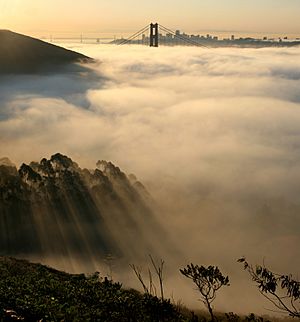
- Advection fog occurs when moist air passes over a cool surface by advection (wind) and is cooled. It is common as a warm front passes over an area with significant snow-pack. It is most common at sea when moist air encounters cooler waters, including areas of cold water upwelling, such as along the California coast (see San Francisco fog). A strong enough temperature difference over water or bare ground can also cause advection fog.
Although strong winds often mix the air and can disperse, fragment, or prevent many kinds of fog, markedly warmer and humid air blowing over a snowpack can continue to generate advection fog at elevated velocities up to 50 mph/80 km/h or more -- this fog will be in a turbulent, rapidly moving, and comparatively shallow layer, observed as inches/a few cm in depth over flat farm fields, flat urban terrain and the like, and/or form more complex forms where the terrain is different such as rotating areas in the lee of hills or large buildings and so on.
The advection of fog along the California coastline is propelled onto land by one of several processes. A cold front can push the marine layer coast-ward, an occurrence most typical in the spring or late fall. During the summer months, a low pressure trough produced by intense heating inland creates a strong pressure gradient, drawing in the dense marine layer. Also during the summer, strong high pressure aloft over the desert southwest, usually in connection with the summer monsoon, produces a south to southeasterly flow which can drive the offshore marine layer up the coastline; a phenomenon known as a "southerly surge", typically following a coastal heat spell. However, if the monsoonal flow is sufficiently turbulent, it might instead break up the marine layer and any fog it may contain. Moderate turbulence will typically transform a fog bank, lifting it and breaking it up into shallow convective clouds called stratocumulus.
- Evaporation fog or steam fog forms over bodies of water overlain by much colder air; this situation can also lead to steam devils forming. Lake effect fog is of this type, sometimes in combination with other causes like radiation fog. It tends to differ from most advective fog formed over land in that it is, like lake-effect snow, a convective phenomenon, resulting in fog which can be quite a bit denser, deeper, and looks fluffy from above. Most other fog is stratiform; steam devils, which look like their dust counterparts, are often seen in this situation.
- Frontal fog forms near a front when raindrops, falling from relatively warm air above a frontal surface, evaporate into cooler air close to the Earth's surface and cause it to become saturated.
- Ice fog forming in very low temperatures can be the result of other mechanisms mentioned here, as well as the exhalation of moist warm air by herds of animals. It can be associated with the diamond dust form of precipitation, in which very small crystals of ice form and slowly fall. This often occurs during blue sky conditions which can cause many types of halos and other results of refraction of sunlight by the airborne crystals.
- Freezing fog, which deposits rime, is composed of droplets of supercooled water which freezes to surfaces on contact.
- Precipitation fog or frontal fog forms as precipitation falls into drier air below the cloud, the liquid droplets evaporate into water vapor. The water vapor cools and at the dewpoint it condenses and fog forms.
- Hail fog sometimes occurs in the vicinity of significant hail accumulations due to decreased temperature and increased moisture leading to saturation in a very shallow layer near the surface. It most often occurs when there is a warm, humid layer atop the hail and when wind is light. This ground fog tends to be localized but can be extremely dense and abrupt. It may form shortly after the hail falls; when the hail has had time to cool the air and as it absorbs heat when melting and evaporating.
- Upslope fog forms when moist air is going up the slope of a mountain or hill which condenses into fog on account of adiabatic cooling, and to a lesser extent the drop in pressure with altitude.
Images for kids
-
View from Blassenstein mountain near Scheibbs (Lower Austria) to the west, with fog over Erlauf valley and Danube
-
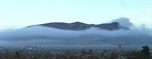
A massive fog bank over Twentynine Palms, California, covers the entire city as it begins to rise and join the clouds above it.
-
Sutro Tower casts a 3-dimensional fog shadow
-
Morning freezing fog in Elko, Nevada
-
Pogonip fog in Virginia City, Nevada, from an early 20th-century postcard
-
Ice fog on Pyhäjärvi, Tampere during sunset.
-
Fog rolls into Seattle from the sea
-
Sea fog or "fret" encroaching on Brighton Pier
-
Sea fog in the Arctic Ocean near the island of Jan Mayen
-
Maple tree with red leaves in the morning mist, in western Estonia
-
A fog on the field of the Leppälahti ja Kuivaniemi villages in Kuopio, Finland
-
Fog hovering over the valleys surrounding La Silla Observatory.
-
Light fog over Taipei, Taiwan with Taipei 101 in the background
-
Fog in London with the Palace of Westminster in the background
See also
 In Spanish: Niebla para niños


