Freeborn County, Minnesota facts for kids
Quick facts for kids
Freeborn County
|
|
|---|---|

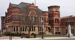
Freeborn County Courthouse
|
|

Location within the U.S. state of Minnesota
|
|
 Minnesota's location within the U.S. |
|
| Country | |
| State | |
| Founded | February 20, 1855 |
| Named for | William Freeborn |
| Seat | Albert Lea |
| Largest city | Albert Lea |
| Area | |
| • Total | 722 sq mi (1,870 km2) |
| • Land | 707 sq mi (1,830 km2) |
| • Water | 15 sq mi (40 km2) 2.1%% |
| Population
(2020)
|
|
| • Total | 30,895 |
| • Estimate
(2023)
|
30,515 |
| • Density | 43.7/sq mi (16.9/km2) |
| Time zone | UTC−6 (Central) |
| • Summer (DST) | UTC−5 (CDT) |
| Congressional district | 1st |
Freeborn County is a county in the state of Minnesota. As of the 2020 census, the population was 30,895. Its county seat is Albert Lea. Freeborn County comprises the Albert Lea Micropolitan Statistical Area.
Contents
History
Freeborn County was created on February 20, 1855, the territory being separated from Blue Earth and Rice Counties. Twelve other Minnesota counties were created the same day by the Minnesota Territorial Legislature. Freeborn County was named for William Freeborn, an early Minnesota pioneer, merchant, and territorial legislator.
Geography
Freeborn County lies on Minnesota's border with Iowa. The Shell Rock River flows southward from Albert Lea Lake in central Freeborn County, crossing into Iowa. Turtle Creek flows eastward through the upper eastern part of the county, crossing into Mower County. The terrain is hilly and etched with drainages and gullies. The Le Sueur River, a tributary of the Minnesota River, begins in the northern part of the county and flows northward into Waseca County. The Cobb River and the Maple River, two other small rivers, begin in the extreme northwest corner of the county, the Cobb from Freeborn Lake and the Maple from Penny Lake. Both run generally northwest, emptying into the LeSueur River, just upstream from where the LeSueur empties into the Minnesota River, on the western edge of Mankato. Most of the available land is devoted to agriculture. The terrain generally slopes to the south and east, although the highest point is near the northeast corner, at 1,296 ft (395 m) ASL. The county has an area of 722 square miles (1,870 km2), of which 707 square miles (1,830 km2) is land and 15 square miles (39 km2) (2.1%) is water.
Lakes
Source:
- Albert Lea Lake
- Bear Lake
- Church Lake
- Everhart Lake
- Fountain Lake
- Freeborn Lake
- Geneva Lake
- Goose Lake
- Halls Lake
- Hickory Lake
- Lower Twin Lake
- Penny Lake
- Pickerel Lake
- School Section Lake
- State Line Lake
- Sugar Lake
- Trenton Lake (part)
- Upper Twin Lake
- White Lake
Protected areas
Source:
- Bear Lake State Wildlife Management Area
- Carex State Wildlife Management Area
- Halls Lake State Wildlife Area
- Moscow State Game Refuge
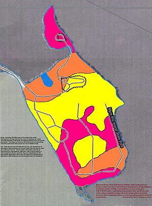
- Myre-Big Island State Park
- White Woods County Park
Transit
- Southern Minnesota Area Rural Transit
Major highways
 Interstate 35
 Interstate 90
 U.S. Highway 65
 U.S. Highway 69
 Minnesota State Highway 13
 Minnesota State Highway 109
 Minnesota State Highway 251
Adjacent counties
- Steele County - northeast
- Mower County - east
- Worth County, Iowa - south
- Winnebago County, Iowa - southwest
- Faribault County - west
- Waseca County - northwest
Demographics
| Historical population | |||
|---|---|---|---|
| Census | Pop. | %± | |
| 1860 | 3,367 | — | |
| 1870 | 10,578 | 214.2% | |
| 1880 | 16,069 | 51.9% | |
| 1890 | 17,962 | 11.8% | |
| 1900 | 21,838 | 21.6% | |
| 1910 | 22,282 | 2.0% | |
| 1920 | 24,692 | 10.8% | |
| 1930 | 28,741 | 16.4% | |
| 1940 | 31,780 | 10.6% | |
| 1950 | 34,517 | 8.6% | |
| 1960 | 37,891 | 9.8% | |
| 1970 | 38,064 | 0.5% | |
| 1980 | 36,329 | −4.6% | |
| 1990 | 33,060 | −9.0% | |
| 2000 | 32,584 | −1.4% | |
| 2010 | 31,255 | −4.1% | |
| 2020 | 30,895 | −1.2% | |
| 2023 (est.) | 30,515 | −2.4% | |
| U.S. Decennial Census 1790-1960 1900-1990 1990-2000 2010-2020 |
|||
2020 Census
| Race | Num. | Perc. |
|---|---|---|
| White (NH) | 25,071 | 81.2% |
| Black or African American (NH) | 460 | 1.5% |
| Native American (NH) | 76 | 0.3% |
| Asian (NH) | 1,135 | 3.7% |
| Pacific Islander (NH) | 5 | 0.02% |
| Other/Mixed (NH) | 965 | 3.12% |
| Hispanic or Latino | 3,183 | 10.3% |
Communities
Cities
Unincorporated communities
- Armstrong
- Corning (partial)
- Gordonsville
- Mansfield
- Maple Island
- Moscow
- Oakland
- Petran
Townships
- Albert Lea Township
- Alden Township
- Bancroft Township
- Bath Township
- Carlston Township
- Freeborn Township
- Freeman Township
- Geneva Township
- Hartland Township
- Hayward Township
- London Township
- Manchester Township
- Mansfield Township
- Moscow Township
- Newry Township
- Nunda Township
- Oakland Township
- Pickerel Lake Township
- Riceland Township
- Shell Rock Township
See also
 In Spanish: Condado de Freeborn para niños


