Dhawalagiri Zone facts for kids
Quick facts for kids
Dhaulagiri Zone
धौलागिरी अञ्चल
|
|
|---|---|

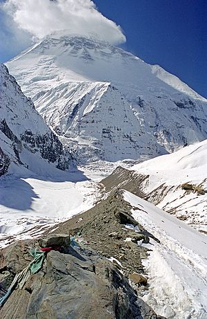
Dhaulagiri Mountain Range
|
|

Dhaulagiri Zone
|
|
| Country | |
| Area | |
| • Total | 8,148 km2 (3,146 sq mi) |
| Population
(2001)
|
|
| • Total | 556,191 |
| • Density | 68.261/km2 (176.795/sq mi) |
| Time zone | UTC+5:45 (Nepal Time) |
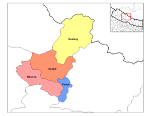
Dhawalagiri (Nepali: धौलागिरी अञ्चल) is one of the fourteen administrative zones of Nepal. According to 2001 census, It has a population of 556,191.
| District | Type | Headquarters |
|---|---|---|
| Baglung | Hill | Baglung |
| Mustang | Mountain | Jomsom |
| Myagdi | Hill | Beni |
| Parbat | Hill | Kusma |
Related pages
- Introduction of Western regions of Nepal.
- About Dhawalagiri Zone and also it's locations.
Images for kids
-
Dhaulagiri Mountain Range
See also
 In Spanish: Zona de Dhaulagiri para niños

All content from Kiddle encyclopedia articles (including the article images and facts) can be freely used under Attribution-ShareAlike license, unless stated otherwise. Cite this article:
Dhawalagiri Zone Facts for Kids. Kiddle Encyclopedia.

