Del Rio, Texas facts for kids
Quick facts for kids
Del Rio, Texas
|
||
|---|---|---|
| City of Del Rio | ||
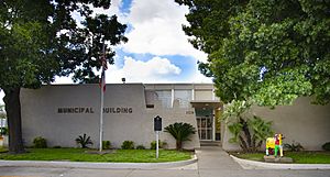
City Hall
|
||
|
||
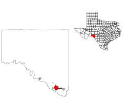
Location of Del Rio, Texas
|
||
| Country | United States | |
| State | Texas | |
| County | Val Verde | |
| Government | ||
| • Type | Council-Manager | |
| Area | ||
| • Total | 20.51 sq mi (53.12 km2) | |
| • Land | 20.44 sq mi (52.94 km2) | |
| • Water | 0.07 sq mi (0.18 km2) | |
| Elevation | 1,002 ft (305.4 m) | |
| Population
(2020)
|
||
| • Total | 34,673 | |
| • Density | 1,749.60/sq mi (675.53/km2) | |
| Time zone | UTC−6 (CST) | |
| • Summer (DST) | UTC−5 (CST) | |
| ZIP code |
78840-78843, 78847
|
|
| Area code | 830 | |
| FIPS code | 48-19792 | |
| Website | CityOfDelRio.com | |
Del Rio is a city in and the county seat of Val Verde County in southwestern Texas, United States. As of 2020, Del Rio had a population of 34,673.
Contents
History
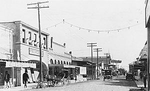
The Spanish established a small settlement south of the Rio Grande in present-day Mexico, and some Spanish colonists settled on the north side of the Rio Grande as early as the 18th century.
The United States acquired the territory following the Mexican War and, after the American Civil War, Paula Losoya Taylor in 1862 was the first Anglo-American to build a hacienda in the area.
San Felipe Springs, about 8 mi (13 km) east of the Rio Grande on the U.S. side of the border, has historically produced 90×106 US gal (340,000 m3) of water a day. This was critical to the arid region. Developers acquired several thousand acres of land adjacent to the springs, and to San Felipe Creek formed by the springs, from the state of Texas in exchange for building a canal system to irrigate the area.
The developers sold tracts of land surrounding the canals to recover their investment and show a profit. The initial investors (William C. Adams, Joseph M. Hudson, John P. Grove, Donald Jackson, John Perry, Joseph Ney, Randolph Pafford, A. O. Strickland, and James H Taylor) formed the San Felipe Agricultural, Manufacturing, and Irrigation Company in 1868. The organization completed construction of a network of irrigation canals in 1871 to support agriculture. Residents referred to the slowly developing town as San Felipe Del Rio. Local lore among the Tejanos said the name came from early Spanish explorers, who offered a mass at the site on St. Philip's Day, 1635.
In 1883, local residents requested a post office be established. The United States Postal Department shortened "San Felipe del Rio" to "Del Rio" to avoid confusion with San Felipe de Austin. In 1885, Val Verde County was organized and Del Rio was designated as the county seat. The City of Del Rio was incorporated on November 15, 1911.
The San Felipe community was started by the Arteaga family. Arteaga Street and Arteaga Park are named after them. Together the communities are still part of a rural region.
Ranchers and farmers recruited Mexican workers during the early decades of the 20th century, especially during World War II, when so many American men were at war. After the war, the government withdrew visas and deported workers, including some who were citizens, as well as children born here.
Like many border communities, Del Rio has been affected in the early 21st century by migrants arriving from Mexico, Central and South America. Migrants from the Caribbean have also crossed the border here.
In September 2021, approximately 30,000 Haitian migrants crossed the border at Del Rio. The United States Border Patrol moved many to a camp underneath the Del Río–Ciudad Acuña International Bridge. The squalid conditions in the camp attracted widespread national attention.
Geography
According to the United States Census Bureau, the city has a total area of 52.3 km2 (20.2 sq mi), of which 52.2 km2 (20.2 sq mi) are land and 0.1 km2 (0.039 sq mi), or 0.24%, is covered by water.
Del Rio lies on the northwestern edges of the Tamaulipan mezquital, also called the South Texas brush country. It is also near the southwestern corner of the Edwards Plateau, which is the western fringe of the famous, oak savanna-covered Texas Hill Country; that area is dotted with numerous small springs; one of these is the San Felipe Springs, which provides a constant flow of water to San Felipe Creek. The creek supplied fresh water for drinking and irrigation to early settlers of Del Rio, and the springs are still the town's water supply.
The Del Rio region, to just west of the Pecos River, has a mix of desert shrub and steppe vegetation depending on soil type, with the gray-leafed cenizo (Leucophyllum spp.), several different acacias, cacti, and grama grasses dominant members of local flora. The terrain is mostly level, but some areas are dissected with substantial canyons and drainages, though none of the upland areas are elevated enough to be considered mountains.
Climate
Del Rio experiences a hot semi-arid climate (Köppen BSh) with mild winters and hot, humid summers. High dewpoint temperatures occur during much of the warmer months, due to the terrain and prevailing surface winds from the southeast. In the spring and fall seasons, severe thunderstorms often build on the Serranías del Burro to the distant west of Del Rio, occasionally affecting Del Rio and uplands to the north. This occurs due to the uplift of moisture from the Gulf of Mexico which is channeled along the Rio Grande, combined with intense heating of lowland areas or frontal and dryline activity. Temperatures peak in late summer and then quickly drop during autumn.
| Climate data for Del Rio International Airport, Texas (1991–2020 normals, extremes 1905–present) | |||||||||||||
|---|---|---|---|---|---|---|---|---|---|---|---|---|---|
| Month | Jan | Feb | Mar | Apr | May | Jun | Jul | Aug | Sep | Oct | Nov | Dec | Year |
| Record high °F (°C) | 92 (33) |
99 (37) |
103 (39) |
107 (42) |
112 (44) |
115 (46) |
112 (44) |
113 (45) |
110 (43) |
106 (41) |
96 (36) |
91 (33) |
115 (46) |
| Mean maximum °F (°C) | 81.4 (27.4) |
87.4 (30.8) |
92.1 (33.4) |
97.9 (36.6) |
102.0 (38.9) |
103.3 (39.6) |
104.4 (40.2) |
104.1 (40.1) |
100.2 (37.9) |
94.6 (34.8) |
85.4 (29.7) |
80.0 (26.7) |
106.9 (41.6) |
| Mean daily maximum °F (°C) | 67.5 (19.7) |
72.7 (22.6) |
80.1 (26.7) |
87.0 (30.6) |
93.1 (33.9) |
98.4 (36.9) |
100.4 (38.0) |
101.0 (38.3) |
93.8 (34.3) |
85.6 (29.8) |
74.8 (23.8) |
67.8 (19.9) |
85.2 (29.5) |
| Daily mean °F (°C) | 55.6 (13.1) |
60.5 (15.8) |
68.1 (20.1) |
74.9 (23.8) |
82.1 (27.8) |
87.7 (30.9) |
89.5 (31.9) |
89.9 (32.2) |
83.5 (28.6) |
74.8 (23.8) |
63.7 (17.6) |
56.1 (13.4) |
73.9 (23.3) |
| Mean daily minimum °F (°C) | 43.6 (6.4) |
48.4 (9.1) |
56.1 (13.4) |
62.8 (17.1) |
71.1 (21.7) |
77.0 (25.0) |
78.7 (25.9) |
78.8 (26.0) |
73.3 (22.9) |
64.1 (17.8) |
52.5 (11.4) |
44.3 (6.8) |
62.6 (17.0) |
| Mean minimum °F (°C) | 26.9 (−2.8) |
29.8 (−1.2) |
35.2 (1.8) |
43.8 (6.6) |
55.0 (12.8) |
67.0 (19.4) |
70.4 (21.3) |
70.5 (21.4) |
58.2 (14.6) |
42.8 (6.0) |
33.1 (0.6) |
27.4 (−2.6) |
24.4 (−4.2) |
| Record low °F (°C) | 12 (−11) |
11 (−12) |
19 (−7) |
33 (1) |
45 (7) |
49 (9) |
63 (17) |
60 (16) |
43 (6) |
28 (−2) |
17 (−8) |
10 (−12) |
10 (−12) |
| Average precipitation inches (mm) | 0.61 (15) |
0.63 (16) |
1.18 (30) |
1.50 (38) |
3.06 (78) |
2.32 (59) |
1.48 (38) |
2.69 (68) |
2.63 (67) |
2.08 (53) |
0.91 (23) |
0.70 (18) |
19.79 (503) |
| Average snowfall inches (cm) | 0.0 (0.0) |
0.1 (0.25) |
0.0 (0.0) |
0.0 (0.0) |
0.0 (0.0) |
0.0 (0.0) |
0.0 (0.0) |
0.0 (0.0) |
0.0 (0.0) |
0.0 (0.0) |
0.0 (0.0) |
0.0 (0.0) |
0.1 (0.25) |
| Average precipitation days (≥ 0.01 in) | 3.9 | 4.5 | 5.0 | 5.0 | 7.0 | 5.2 | 3.7 | 4.2 | 5.9 | 5.5 | 4.4 | 4.4 | 58.7 |
| Average snowy days (≥ 0.1 in) | 0.0 | 0.1 | 0.0 | 0.0 | 0.0 | 0.0 | 0.0 | 0.0 | 0.0 | 0.0 | 0.0 | 0.0 | 0.1 |
| Source 1: NOAA | |||||||||||||
| Source 2: National Weather Service | |||||||||||||
Demographics
| Historical population | |||
|---|---|---|---|
| Census | Pop. | %± | |
| 1880 | 50 | — | |
| 1890 | 1,980 | 3,860.0% | |
| 1900 | 2,098 | 6.0% | |
| 1910 | 5,688 | 171.1% | |
| 1920 | 10,589 | 86.2% | |
| 1930 | 11,693 | 10.4% | |
| 1940 | 13,343 | 14.1% | |
| 1950 | 14,211 | 6.5% | |
| 1960 | 18,612 | 31.0% | |
| 1970 | 21,330 | 14.6% | |
| 1980 | 30,034 | 40.8% | |
| 1990 | 30,705 | 2.2% | |
| 2000 | 33,867 | 10.3% | |
| 2010 | 35,591 | 5.1% | |
| 2020 | 34,673 | −2.6% | |
| U.S. Decennial Census [1] |
|||
2020 census
| Race | Number | Percentage |
|---|---|---|
| White (NH) | 4,530 | 13.06% |
| Black or African American (NH) | 383 | 1.1% |
| Native American or Alaska Native (NH) | 36 | 0.1% |
| Asian (NH) | 247 | 0.71% |
| Pacific Islander (NH) | 23 | 0.07% |
| Some Other Race (NH) | 61 | 0.18% |
| Mixed/Multi-Racial (NH) | 319 | 0.92% |
| Hispanic or Latino | 29,074 | 83.85% |
| Total | 34,673 |
As of the 2020 United States census, there were 34,673 people, 12,300 households, and 8,898 families residing in the city.
Micropolitan area
Del Rio is the principal city of the Del Rio micropolitan statistical area, which includes all of Val Verde County; the micropolitan area had an estimated population over 50,000 in 2007. Located across from Del Rio, in the Mexican state of Coahuila, is the city of Ciudad Acuña, with a city population of 201,161.
Economy
Laughlin Air Force Base
In 1942, the Army Air Corps opened Laughlin Field 9 mi (14 km) east of Del Rio, as a training base for the Martin B-26, but the base was deactivated in 1945. As the Cold War pressures built, along with new border-control issues, Laughlin Field was rebuilt and renamed Laughlin Air Force Base and was again used as a home for flight training. Laughlin plays a large part in the Del Rio community as the area's largest employer. Today Laughlin Air Force Base is the largest pilot training base in the Air Force.
Val Verde Correctional Facility
The GEO Group, a private correctional facility corporation based in Boca Raton, Florida, manages the Val Verde Correctional Facility in Del Rio. It has a contract to house offenders for the county, for the U.S. Marshals Service (male/female) prisoners, and U.S. Customs and Border Protection detainees. The facility opened in 2001 with 688 beds. In 2007, the facility was expanded to its current capacity of 1,400 beds. It is one of the major employers in the Del Rio area and meets standards required by state and federal guidelines.
Arts and culture
Some of the earliest surviving cultural artefacts in the region are various pictographs found in local caverns in and near the town. Some of these pictographs date back 4,200 years, when the people of precontact cultures in the region created pictographs in the caverns of the Lower Pecos Canyonlands Archeological District, a proposed National Historic Landmark. The pictographs are preserved in part by the Shumla Archaeological Research and Education Center, a local group that documents the pictographs, and creates educational material about them.
The Whitehead Memorial Museum carries on the history of the culture created in Del Rio. It also includes mementos of Judge Roy Bean.
The Laughlin Heritage Museum Foundation educates the public about the importance of air power in sustaining the national security of the United States, and to preserve the heritage of Laughlin Air Force Base, Texas.
Del Rio is home to the oldest continuously running winery in Texas, the Val Verde Winery. The winery was established in 1883 by Italian immigrant Frank Qualia. He brought with him his family tradition of winemaking. Today, the winery is operated by third-generation vintner Thomas Qualia.
A cultural melting pot, Del Rio is home to people of a mix of ethnic and racial backgrounds, including Hispanic, Black Seminole, Mestizo, and Tejano.
Del Rio offers a variety of Southwestern cuisine including: Tex-Mex, steakhouses, barbecue, authentic Mexican food, and Pan Dulce or Mexican pastries.
The Upstagers have been performing award-winning live theater in Del Rio since 1977.
The Casa de la Cultural is a non-profit organization that has provided community-focused outlets for the youth and adults in Del Rio for over 40 years. It offers a revolving variety of classes based on the educational and cultural needs of the community, such as: Ballet Folklorico, Guitar, Singing, Knitting, Pottery, Art Camps, Latino Aerobics and Literacy classes. In the early 2000s, the Casa de la Cultura began Noches Musicales, a live summer music festival with food vendors and live music. The Casa de la Cultura celebrated their 14th annual Live Music Festival in June 2021.
The Del Rio Council for the Arts provides affordable arts and education and entertainment to the community and its surrounding areas.
Del Rio is home to the annual event of the George Paul Memorial Bullriding, which is the oldest such stand-alone event in the world.
Some of the most notable celebrations in the community include: Cinco de Mayo, the July 4th Independence Day City-Wide Celebration, 16 de Septiembre, Fiesta de Amistad, and the Fiesta of Flight Air Show. Del Rio held its first ever Pride event in June 2019.
Del Rio is home to consulates of Guatemala and Mexico.
The area is home to various religious groups including: Christian, Baptist, Catholic, Episcopal, Evangelical, Lutheran, Methodist, Non-Denominational, Pentecostal, Presbyterian, Spirit-Filled, Judaism, Seventh Day Adventist, and many more.
Education
The city is served by the San Felipe Del Rio Consolidated Independent School District. About 10,450 students are enrolled and 637 teachers are employed at 14 campuses throughout the district. Del Rio is also home to Del Rio Heritage Academy High School, and Premier High School, two charter schools.
Higher education
Two four-year universities have campuses in Del Rio: Sul Ross State University and Park University.
Southwest Texas Junior College, a two-year community college, has a campus in Del Rio.
Media
The Del Rio News-Herald was a daily newspaper published in Del Rio, covering Val Verde County, and was owned by Southern Newspapers Inc. The newspaper had a daily circulation of 10,400 and a Sunday circulation of 13,500. After disruption and losses during the first year of the Covid 19 pandemic, the newspaper closed in November 2020.
In 2020, The 830 Times, a local news website covering Del Río and the wider region of Southwest Texas, launched its print and online newspaper. It is published weekly.
Radio
There are multiple radio stations licensed to the area in and around Del Rio including, KDLK-FM, KTDR, KVFE, KWMC, KDRN, KTPD, KDLI.
In 2014, KVFE, a Christian station owned by Inspiracom, was launched to fill one of the ministry's remaining gaps on the US–Mexico border.
In 2016, Texas Public Radio opened a transmitter in Del Rio.
Digital
In 2020, The 830 Times launched. It is a local news website covering Del Rio and the wider region of Southwest Texas.
Infrastructure
Transportation
Del Rio International Airport (FlyDRT) serves the city and surrounding area. American Airlines has operated flights twice daily between Del Rio and Dallas/Fort Worth International Airport in the past. The route is currently served by two cargo airlines. On January 5, 2023, the City of Del Rio announced that American Airlines will terminate service to DRT effective April 3, 2023, leaving Del Rio without scheduled air passenger service.
Transportation services to the citizens of Del Rio is provided by the City of Del Río Transportation Department.
Amtrak provides passenger rail service to Del Rio station through its combined Sunset Limited/Texas Eagle service. Trains serve the station thrice-weekly in each direction, with direct service to Los Angeles, San Antonio, New Orleans, Chicago, and points in between.
Major highways
- U.S. Route 90 connects with Alpine, Marfa, and El Paso to the west, Uvalde and San Antonio to the east.
- U.S. Route 277 connects with San Angelo to the north and Crystal City and Laredo (by U.S. Route 83) to the southeast.
- U.S. Route 377 crosses sparsely populated West Texas through several small towns before eventually reaching Fort Worth.
- Texas State Highway Loop 79 in Val Verde County and Del Rio, known as a Super Two Loop, opened for traffic in mid-May 2012. It connects with U.S. Route 90, U.S. Route 277, and U.S. Route 377; Loop 79 is part of the Ports to Plain Corridor Infrastructure and the future Interstate 27 that extends from Laredo to Denver, Colorado.
 US 90
US 90 US 277
 US 377
 SH 297
 SH 239
 SH 79
SH 79
Notable people
- Jessica Alba (born 1981), actress, was a resident when her father was stationed at Laughlin AFB
- Consuelo González Amezcua (1903–1975), outsider artist and poet
- Lance Blanks (1966-2023), NBA player who was drafted in the first round of the 1990 NBA draft by the Detroit Pistons, and was the general manager of the NBA's Phoenix Suns from 2010 to 2013
- Larvell Blanks (born 1950), MLB infielder for the Atlanta Braves, Cleveland Indians and Texas Rangers
- Sid Blanks (1941-2021), halfback for the Houston Oilers and Boston Patriots of the American Football League
- Radney Foster (born 1959), country music singer/songwriter; his first album, Del Rio, TX 1959, was released in 1992.
- Bob Gruber (born 1958), retired offensive tackle in the NFL and USFL
- Todd Hays (born 1969), bobsledder who won the silver medal in the four-man event at the 2002 Winter Olympics in Salt Lake City, Utah
- Cory James (born 1993), NFL football player for the Oakland Raiders and former player for Colorado State University
- Jay Kerr (born 1948), actor who has appeared in various movies and television series, including his role as Con Madigan in the Australian series Five Mile Creek
- Jack Mayfield (born 1990), an American professional baseball infielder for the Los Angeles Angels of Major League Baseball (MLB)
- Shawn Michaels (born 1965), a professional wrestler, was a resident when his father was stationed at Laughlin Air Force Base
- Evelyn Peirce (1907–1960), actress
- Jerry Edwin Smith (born 1946), judge of the United States Court of Appeals for the Fifth Circuit
- Byron Velvick (born 1964), Bassmasters pro fisherman and reality show contestant on The Bachelor
- Hoke Hayden "Hooks" Warner (1894–1947), MLB player for the Chicago Cubs and Pittsburgh Pirates in the early 20th century
- Jeremy Silman (1954–2023), chessplayer
Neighborhoods
Rincon del Diablo: The section where Barron St. meets Magnolia Street.
Barrio Chihuahua: In the southern part of the city, this neighborhood, named after the Chihuahua Soccer Field, is located between West Gibbs to the north, Texas State Spur 29 to the west, Garfield Ave., West Garfield to the southeast, and S. Ave F to the far east.
Buena Vista: Located near Buena Vista Park. Lake Amistad and North Del Rio are located past the Buena Vista area.
Cienegas Terraces: Outside the city limits, it is home to the "Duck Pond" and various ranches, on the west side of the city.
Eastside: Named by locals after the school on the corner of Bedell & 7th Street, the neighborhood is also home to Star Park. Surrounded by Veterans Boulevard to the west and E. Gibbs to the south, the neighborhood is home to the Val Verde Regional Medical Center.
San Felipe: The original neighborhood in Del Rio, the city originally got its name from it as in "San Felipe del rio", south of Barrio Chihuahua and the Northside. Home of the San Felipe Creek.
Qualia: Home to Val Verde Winery, the oldest operating winery in Texas. Next door to the San Felipe neighborhood. Residents living within the Qualia area reference the neighborhood as "the one by the Winery," Many historical markers are located within the vicinity.
Westside: Home to Del Rio International Airport, the neighborhood is surrounded to the north by W. 15th, 18th, and 17th Streets, to the east by Veterans Blvd., and to the south by W. Gibbs bordering Chihuahua.
Comalia: A neighborhood isolated by the Woodlawn cemetery and a bridge that leads to the U.S.-Mexico border crossing, it can be found by traveling down W. 2nd Street.
See also
 In Spanish: Del Río (Texas) para niños


