Darien, Connecticut facts for kids
Quick facts for kids
Darien, Connecticut
|
|||
|---|---|---|---|
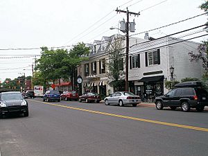
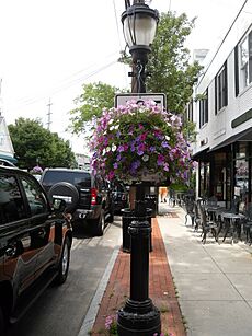
Boston Post Road in Darien's retail district
|
|||
|
|||
 Fairfield County and Connecticut Fairfield County and Connecticut Western Connecticut Planning Region and Connecticut Western Connecticut Planning Region and Connecticut |
|||
| Country | United States | ||
| U.S. state | Connecticut | ||
| County | Fairfield | ||
| Region | Western CT | ||
| Incorporated | 1820 | ||
| Government | |||
| • Type | Representative town meeting | ||
| Area | |||
| • Total | 23.4 sq mi (60.6 km2) | ||
| • Land | 12.9 sq mi (33.4 km2) | ||
| • Water | 10.6 sq mi (27.4 km2) | ||
| Elevation | 52 ft (16 m) | ||
| Population
(2020)
|
|||
| • Total | 21,499 | ||
| • Density | 1,666.6/sq mi (643.5/km2) | ||
| Time zone | UTC−5 (Eastern) | ||
| • Summer (DST) | UTC−4 (Eastern) | ||
| ZIP Code |
06820
|
||
| Area code(s) | 203/475 | ||
| FIPS code | 09-18850 | ||
| GNIS feature ID | 0213416 | ||
Darien (/ˌdɛəriˈæn/ dair-EE-an) is a coastal town in Fairfield County, Connecticut, United States. With a population of 21,499 and a land area of just under 13 square miles (34 km2), it is the smallest town on Connecticut's Gold Coast.
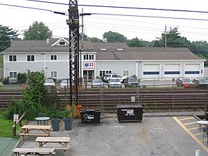
Situated on the Long Island Sound between the cities of Stamford and Norwalk, Darien is a commuter town for New York City. There are two railroad stations in Darien, Noroton Heights and Darien, linking the town to Grand Central Terminal.
Contents
History
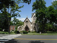
According to early records, the first clearings of land were made by men from the New Haven and Wethersfield colonies and from Norwalk in about 1641. It was not until 1740, however, that the Middlesex Society of the Town of Stamford built the first community church, now the First Congregational Church of Darien (which stands on the original site at the corner of Brookside Road and the Boston Post Road).
The area became Middlesex Parish in 1737. It was incorporated as the Town of Darien in 1820. Tories (Loyalists) raided the town several times during the American Revolution, at one point taking 26 men in the parish prisoner for five months, including the Reverend Moses Mather, pastor of the parish. The Loyalist-Patriot conflict in Darien is the setting for the novel Tory Hole, the first book by children's author Louise Hall Tharp.
According to the Darien Historical Society, the name Darien was decided upon when the residents of the town could not agree on a name to replace Middlesex Parish, many families wanting it to be named after themselves. A sailor who had traveled to Darién, Panama, then part of the Spanish Empire, suggested the name Darien, which was eventually adopted by the people of the town.
The town name is pronounced (like "Dairy-Ann"), with stress on the last syllable, and has been referred to as such at least as far back as 1913. Residents say this is still the proper pronunciation, which in most American English, including the local variety, is more precisely. "You can always tell when someone is not from here, because they do pronounce it the way it's spelled," Louise Berry, director of the town library, said in a 2006 interview.
Until the advent of the railroad in 1848, Darien remained a small, rural community of about 1,000. After the Civil War, the town became one of the many resorts where New Yorkers built luxurious, grand summer homes.
Darien has a well-established reputation as a former sundown town, having effectively kept out African American and Jewish families for decades.
Geography
According to the United States Census Bureau, the town has a total area of 14.8 square miles (38 km2), of which 12.9 square miles (33 km2) is land and 2.0 square miles (5.2 km2), or 13.41%, is water. The town has four exits on the northbound-traffic side of Interstate 95 (Exits 10–13) and three on the southbound-traffic side (where there is no Exit 12). Its northern border is just south of the Merritt Parkway, where Exits 36 and 37 are closest to the town. It also has two Metro-North railroad stations for commuter trains into New York City, with a 38 to 39 miles (61 to 63 km) commute of 46–50 minutes from Noroton Heights and 49–53 minutes from Darien. (The Talmadge Hill railroad station on the New Canaan Branch is within walking distance of homes at the far northwestern corner of town, and the Rowayton railroad station is within walking distance of homes near Raymond Street in the southeastern part of town.) Most trains run non-stop after Stamford into New York City's 125th Street, then Grand Central Terminal. Along with the New Haven Line of Metro-North Railroad and Interstate 95, US Route 1, known locally as the Boston Post Road, or, more commonly, the Post Road, runs east-west through the southern side of town. Except for the Noroton Heights business district, commercial zoning is extremely limited outside of the town-wide strip along the Post Road.
Darien is bordered on the west by Stamford, on the north by New Canaan, and on the east by Norwalk. On the south it faces Long Island Sound. It is part of the "panhandle" of Connecticut jutting into New York state. The town has 16.5 miles (26.6 km) of coastline and five harbors.
Sections of the town
In addition to some small neighborhoods, the larger divisions of the town are Downtown Darien (area surrounding Boston Post Road from I-95 to Brookside Road), Noroton (roughly in the southwest corner of town on Boston Post Road), Ox Ridge (northern end of Mansfield Avenue), (Noroton Heights (roughly north of Interstate 95 to Middlesex Middle School with an eastern boundary of Noroton Avenue), Noroton Bay (southern end of Noroton Neck), Long Neck Point (southernmost part of town up to historic Ring's End Landing), Delafield Island (waterfront community in between Long Neck and Tokeneke) and Tokeneke (mostly private community in the southeastern end of town).
The name Noroton originates from the Native American "Norporiton" assigned to the river along Darien's border with Stamford. This section of Darien is defined by two peninsulas that claw their way into Long Island Sound, their curved appendages protecting enough coves and inlets to make the area a haven for beachgoers and sailors. The shorter of the peninsulas, Noroton Neck, is divided into shore communities like Noroton Bay and Pratt Island. Long Neck, which extends farther into Long Island Sound includes Long Neck Point which provides westerly views of Manhattan. Though the general geographic reference to this land feature is Long Neck Point, therein are two different neighborhoods, each with their own main road and distinct features.
Connecticut’s Gold Coast, Long Neck Point is consistently ranked one of the best places to live in America. Historically, it has also been called Collender’s Point and “La Belle” Point. In 1902, Anson Phelps Stokes of the Stokes family built a Gilded Age brick Georgian manor on the end, dubbed "Brick House" which was later occupied by Andrew Carnegie. Carnegie’s manor was later run as the Convent of the Sacred Heart before it was split in half and sold as two private residences. The property on the tip was divided in two and neither home can rise above 20 feet.
On its east side, Long Neck Point Road stretches south beginning near the Ring's End Landing bridge and terminating at the southerly most tip of land. This area is somewhat inland and away from the eastern shoreline and at a relatively high elevation above the water. The west coast of Long Neck runs along Goodwives River and includes Pear Tree Point. A public beach, Pear Tree Point Park and a private boat club, the Darien Boat Club are on Pear Tree Point in Noroton Harbor. Pear Tree Point Road, begins at the Ring's End Landing bridge, runs south along the western side of the Point adjacent to "The Gut" and to outer Noroton Harbor. This charming route hugs the shoreline at an elevation close enough to the tides such that storm conditions can bring the water level over the road. Approximately half-way south along the peninsula, Pear Tree Point Road turns abruptly to the east, ninety degrees, heading uphill and connecting to Long Neck Point Road, distinguishing Long Neck from Long Neck Point.
Ring's End Landing, the original settlement and shipping point for early residents includes a historic stone bridge providing easier access to Long Neck, essential after the creation of the New Haven Railroad. Long Neck became a summer destination for the wealthy when rail travel made it accessible during the mid-19th century. The bridge crosses a dam dividing Gorhams Pond from the Gut.
The large island to the east is the remaining estate of the late William Ziegler. The Ziegler Estate is the most expensive waterfront plot on the eastern seaboard. With an assessed property value of over $22,000,000 and thousands of feet of direct undeveloped waterfront, it boasts the fourth largest property tax in town. For the first time in over a century, the 63-acre portion of the estate known as Great Island was listed for sale and is expected to set a national record at $175,000,000.
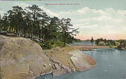
Darien's eastern coastline is almost entirely Tokeneke, a private community with a beach, club, and police patrol. Coveted Contentment Island sits in the southeastern most part of town, encompassed by Tokeneke.
Noroton Heights "blew up around the Noroton Heights train station and housed the European immigrants who serviced the old estates," according to an article about the community in The New York Times. The densely populated streets of this part of town are full of "modest Capes and colonials" along with other house styles.
Climate
Darien has a humid continental climate, similar to that of New York City, with mild to warm humid summers and cold to very cold winters. The highest recorded temperature was 103 °F (39 °C) in July 1966, while the lowest recorded temperature was -15 °F (-26 °C) in 1968. Snowfall is generally frequent in winter while average precipitation is most common in September.
Demographics
| Historical population | |||
|---|---|---|---|
| Census | Pop. | %± | |
| 1820 | 1,126 | — | |
| 1850 | 1,454 | — | |
| 1860 | 1,705 | 17.3% | |
| 1870 | 1,808 | 6.0% | |
| 1880 | 1,949 | 7.8% | |
| 1890 | 2,276 | 16.8% | |
| 1900 | 3,116 | 36.9% | |
| 1910 | 3,946 | 26.6% | |
| 1920 | 4,184 | 6.0% | |
| 1930 | 6,951 | 66.1% | |
| 1940 | 9,222 | 32.7% | |
| 1950 | 11,767 | 27.6% | |
| 1960 | 18,437 | 56.7% | |
| 1970 | 20,336 | 10.3% | |
| 1980 | 18,892 | −7.1% | |
| 1990 | 18,196 | −3.7% | |
| 2000 | 19,607 | 7.8% | |
| 2010 | 20,752 | 5.8% | |
| 2020 | 21,499 | 3.6% | |
| U.S. Decennial Census | |||
As of the census of 2000, there were 19,607 people, 6,592 households, and 5,385 families residing in the town. The population density was 1,525.2 inhabitants per square mile (588.9/km2). There were 6,792 housing units at an average density of 203.9 inhabitants/km2 (528.3 persons/sq mi). The racial makeup of the town was 95.97% White, 0.45% African American, 0.04% Native American, 2.42% Asian, 0.03% Pacific Islander, 0.30% from other races, and 0.80% from two or more races. Hispanic or Latino of any race were 2.19% of the population. In 2019, the median household income was $232,523 and the per capita income for the town was $116,564.
Arts and recs
Annual events
- May – Memorial Day Parade.
- June – Weed Beach Fest.
- October – Downtown Halloween Parade.
Library
Darien's library was founded in 1894. Andrew Carnegie offered funds for a library, and was rejected. The Darien Library is the most heavily utilized library in Connecticut.
Landmarks
- Frederick J. Smith House, by Richard Meier, was complete in 1967.
- Stephen Tyng Mather Home is a National Historic Landmark, and is listed on the National Register of Historic Places.
Parks and recreation
The Darien Ice House is an ice rink.
Founded in 1928, Noroton Yacht Club runs the largest junior sailing program in the United States.
Education
Darien is served by the Darien Public Schools, and Darien High School was ranked No. 1 in the "U.S. News Best High Schools in Connecticut" in 2019. The school also ranked in the top 150 in the national rankings, and in the top 50 in STEM high schools in the United States. Darien has five elementary schools: Hindley School, Holmes School, Ox Ridge School, Royle School, and Tokeneke School. A $27 million addition was completed in 2000 to the town's middle school, Middlesex Middle School, and a new $73 million campus for Darien High School was completed in the fall of 2005. Darien sports teams go by the name of the "Blue Wave".
Pear Tree Point School, originally named Plumfield School, was a private school on Long Neck, educating students in pre-kindergarten through Grade 5. The school was closed in summer 2018.
Media
Darien is served by a local print/online weeklies, the Darien Times, four exclusively online local news websites, Darienite, HamletHub Darien, the Darien Patch, and The Daily Voice, Darien. A monthly magazine known as New Canaan and Darien Magazine is also published covering Darien, New Canaan, and Rowayton (a section of the city of Norwalk). Sound Watch Magazine. is another monthly publication, founded in 2019, dedicated to local news and history of the area. Most public meetings are filmed and broadcast live, and recorded for later broadcast by Cablevision's Channel 79 Government Access.
Film
Films at least partially filmed in Darien with release date include:
- Gypsy (2017)
- Hope Springs (2012)
- Hello I Must Be Going (2012)
- My Soul to Take (2010)
- Birds of America (2008)
- Revolutionary Road (2008)
- The Big Wedding (2013)
- The Life Before Her Eyes (2007)
- The Stepford Wives (2004)
- Cannonball Run II (1984)
- The Stepford Wives (1975)
- Gentleman's Agreement (1947) – based on a book by Laura Hobson that portrayed Darien as a restricted community that excludes Jews.
- The Perfect Date (2019) – a young man obsessed with getting into Yale pretends to be from Darien to impress a wealthy Greenwich woman.
Infrastructure
Emergency
Ambulance
An ambulance service, known as "Darien EMS – Post 53" is the only ambulance service in the nation staffed and run entirely by high school student volunteers, covers one of the deadliest stretches of Interstate 95, and responds to over 1,500 emergency calls annually. The Explorer post is chartered under the Connecticut Yankee Council, and is considered a scouting unit. The service provides emergency care at no cost to the patient, funded entirely by private donations from town residents. Teenagers are allowed to perform patient care due to the fact that Connecticut is one of the few states in the nation which allows emergency medical technicians to be certified at age 16. The town is served by two train stations, Noroton Heights and Darien station. The Connecticut Turnpike (Interstate 95) and Post Road (U.S. Route 1.) pass through Darien. Interstate 95 has rest stops in Darien for the southbound and northbound lanes.
Notable people
-
Long Neck Point from Contentment Island by John Frederick Kensett, collection of the Metropolitan Museum of Art, depicting the area where Andrew Carnegie spent some summers
See also
 In Spanish: Darien (Connecticut) para niños


