Chester County, Tennessee facts for kids
Quick facts for kids
Chester County
|
|
|---|---|

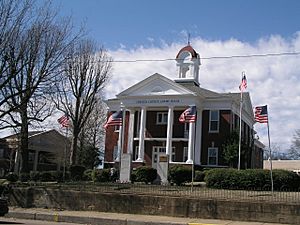
Chester County Courthouse in Henderson, 2003
|
|

Location within the U.S. state of Tennessee
|
|
 Tennessee's location within the U.S. |
|
| Country | |
| State | |
| Founded | 1882 |
| Named for | Robert Chester |
| Seat | Henderson |
| Largest city | Henderson |
| Area | |
| • Total | 286 sq mi (740 km2) |
| • Land | 286 sq mi (740 km2) |
| • Water | 0.2 sq mi (0.5 km2) 0.08%% |
| Population
(2020)
|
|
| • Total | 17,341 |
| • Density | 60/sq mi (20/km2) |
| Time zone | UTC−6 (Central) |
| • Summer (DST) | UTC−5 (CDT) |
| Congressional district | 8th |
Chester County is a county located in the U.S. state of Tennessee. As of the 2020 census, the population was 17,341. Its county seat is Henderson. The county was created in 1879 and organized in 1882. Chester County is included in the Jackson, TN Metropolitan Statistical Area.
Contents
History
Chester County was the last county formed in Tennessee, created by the General Assembly in 1875 from adjacent parts of neighboring Hardeman, Henderson, McNairy, and Madison counties. This land was used to create a county named Wisdom County, but "Wisdom County" was never organized, and in March 1879 the Assembly repealed this and created Chester County out of the same land. Lawsuits by opponents of the creation of the new county delayed actual organization until 1882. Chester County was named for Colonel Robert I. Chester, a quartermaster in the War of 1812, an early postmaster in Jackson, and a federal marshal.
Geography
According to the U.S. Census Bureau, the county has a total area of 286 square miles (740 km2), of which 286 square miles (740 km2) is land and 0.2 square miles (0.52 km2) (0.08%) is water.
Adjacent Counties
- Henderson County (northeast)
- Hardin County (southeast)
- McNairy County (south)
- Hardeman County (southwest)
- Madison County (northwest)
State protected areas
- Chickasaw State Park
- Chickasaw State Forest (part)
Demographics
| Historical population | |||
|---|---|---|---|
| Census | Pop. | %± | |
| 1890 | 9,069 | — | |
| 1900 | 9,869 | 8.8% | |
| 1910 | 9,090 | −7.9% | |
| 1920 | 9,669 | 6.4% | |
| 1930 | 10,603 | 9.7% | |
| 1940 | 11,124 | 4.9% | |
| 1950 | 11,149 | 0.2% | |
| 1960 | 9,569 | −14.2% | |
| 1970 | 9,927 | 3.7% | |
| 1980 | 12,727 | 28.2% | |
| 1990 | 12,819 | 0.7% | |
| 2000 | 15,540 | 21.2% | |
| 2010 | 17,131 | 10.2% | |
| 2020 | 17,341 | 1.2% | |
| U.S. Decennial Census 1790-1960 1900-1990 1990-2000 2010-2014 |
|||
2020 census
| Race | Perc. |
|---|---|
| White (non-Hispanic) | 84.5% |
| Black or African American (non-Hispanic) | 9.5% |
| Native American | 0.6% |
| Asian | 0.8% |
| Other/Mixed | 2.1% |
| Hispanic or Latino | 3.0% |
As of the 2020 United States census, there were 17,341 people, 6,060 households, and 4,471 families residing in the county.
Education
There are six schools in the Chester County School District. Chester County High School serves the whole county and holds grades 9–12. Chester County Junior High School holds grades 6 through 8 for the entire county. Chester County Middle School serves the whole county's students in grades 4 and 5. East Chester County Elementary School, West Chester County Elementary School, and Jacks Creek Elementary School all hold kindergarten through 3rd grade.
Henderson is the home of Freed-Hardeman University.
Communities
City
- Henderson (County Seat)
Town
- Enville (partial)
- Milledgeville (partial)
- Silerton (partial)
- Finger (partial)
Unincorporated communities
See also
 In Spanish: Condado de Chester (Tennessee) para niños


