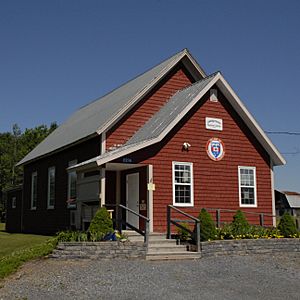
Cambridge-Narrows facts for kids
Quick facts for kids
Cambridge-Narrows
|
|
|---|---|

Cambridge-Narrows Regional Library
|
|
| Country | Canada |
| Province | New Brunswick |
| County | Queens |
| Parish | Cambridge |
| Municipality | Arcadia |
| Incorporated | 1966 |
| Area | |
| • Land | 106.79 km2 (41.23 sq mi) |
| Population
(2021)
|
|
| • Total | 715 |
| • Density | 6.7/km2 (17/sq mi) |
| • Change 2016–21 | |
| Time zone | UTC-4 (EST) |
| • Summer (DST) | UTC-3 (EDT) |
Cambridge-Narrows is a former village in Queens County, New Brunswick, Canada. It held village status prior to 2023 and is now part of the village of Arcadia.
The village straddled Washedemoak Lake, a widening of the Canaan River, several kilometres upstream of the Saint John River. Cambridge-Narrows has 3 main arteries, Route 695, Route 715, and Route 710
History
The Cambridge-Narrows consisted of two separate settlements on either side of the river, Cambridge and The Narrows, which were merged under one municipal government in 1966.
On 1 January 2023, Cambridge-Narrows amalgamated with the village of Gagetown and all or part of five local service districts to form the new village of Arcadia. The community's name remains in official use.
Demographics
In the 2021 Census of Population conducted by Statistics Canada, Cambridge-Narrows had a population of 715 living in 345 of its 629 total private dwellings, a change of 27.2% from its 2016 population of 562. With a land area of 106.79 km2 (41.23 sq mi), it had a population density of 6.7/km2 (17/sq mi) in 2021.
Notable people
Bordering communities
- Hampton
- Big Cove
- McDonald Corner
- Jemseg
- Hatfield Point
- Springfield, Kings County


