List of historic places in Queens County, New Brunswick facts for kids
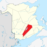
This is a list of historic places in Queens County, New Brunswick entered on the Canadian Register of Historic Places, whether they are federal, provincial, or municipal.
List of historic places
| Name | Address | Municipality | PC | Coordinates | IDF | IDP | IDM | Image | |
|---|---|---|---|---|---|---|---|---|---|
| Barrack Block | Dufferin Drive | Arcadia | 45°50′16″N 66°26′12″W / 45.8378°N 66.4367°W | 15391 | |||||
| Barrack Block | Dufferin Drive | Arcadia | 45°50′16″N 66°26′13″W / 45.8378°N 66.4370°W | 15364 | |||||
| Drill Hall D15 | CFB Gagetown | Arcadia | 10894 | ||||||
| Drill Hall H12 | St. Jean Avenue, CFB Gagetown | Arcadia | 45°50′42″N 66°27′21″W / 45.8450°N 66.4559°W | 10892 | |||||
| Nehemiah Belyea House | 3259 Lower Cambridge Road | Arcadia | 45°45′20″N 66°00′53″W / 45.7556°N 66.0147°W | 15651 | |||||
| Cambridge-Narrows Municipal Building | 6 Municipal Lane | Arcadia | E4C | 45°49′39″N 65°57′22″W / 45.8276°N 65.956°W | 15646 | ||||
| Cambridge-Narrows Regional Library | 2216 Lakeview Road | Arcadia | E4C | 45°49′55″N 65°57′16″W / 45.832°N 65.9544°W | 15645 |  |
|||
| Chipman Community Heritage Centre | 238 Main Street | Chipman | E4A | 46°10′33″N 65°52′51″W / 46.1759°N 65.8809°W | 12222 | ||||
| Claremont | 104 Tilley Road | Arcadia | E5M | 45°47′19″N 66°08′47″W / 45.7885°N 66.1464°W | 15603 | ||||
| Codys Women's Institute Hall | 1 Codys Lane | Johnston | E4C | 45°52′29″N 65°49′36″W / 45.8746°N 65.8266°W | 7734 | ||||
| Archdeacon Hiram A. Cody House | 37 Codys Lane | Codys | E4C | 45°52′14″N 65°49′48″W / 45.8706°N 65.8299°W | 9991 | ||||
| Cossar Farm Site | 16 Fox Road | Arcadia | E5M | 45°44′26″N 66°08′06″W / 45.7406°N 66.1349°W | 15943 | ||||
| Cow Point Site | Scotchtown Road | Scotchtown | E4B | 45°52′46″N 66°10′02″W / 45.8795°N 66.1673°W | 13155 |  |
|||
| Darrah's Insurance Ltd. Building | 267 Main Street | Chipman | E4A | 46°10′29″N 65°52′56″W / 46.1746°N 65.8822°W | 12241 | ||||
| Anthony Flower House | Lower Cambridge Road | Arcadia | E4C | 45°49′41″N 65°57′26″W / 45.828°N 65.9572°W | 15643 | ||||
| Glenora | 7 Peters Street | Arcadia | E5M | 45°47′00″N 66°08′44″W / 45.7833°N 66.1455°W | 15944 | ||||
| Hector House | 20 Front Street | Arcadia | E5M | 45°46′48″N 66°08′37″W / 45.78°N 66.1436°W | 15946 | ||||
| Hendry Farm Lighthouse | Washademoak Lane | Arcadia | E4C | 45°43′58″N 66°02′54″W / 45.7329°N 66.0482°W | 15497 | ||||
| History of Coal Mining Monument | 187 Main Street (adjacent) | Minto | E4B | 46°04′32″N 66°04′24″W / 46.0755°N 66.0734°W | 12242 | ||||
| Jemseg Archaeological Site | Highway 695 | Arcadia | E4C | 45°49′44″N 66°06′59″W / 45.8288°N 66.1163°W | 7990 | ||||
| Junior Ranks Quarters | Cartier Crescent | Arcadia | 45°50′16″N 66°26′12″W / 45.8378°N 66.4367°W | 15386 | |||||
| Dr. Malcolm MacDonald House | 2224 Lakeview Road | Arcadia | E4C | 45°49′53″N 65°57′18″W / 45.8314°N 65.9551°W | 15649 | ||||
| Orange Hall Museum | Court House Road | Arcadia | E4C | 45°47′09″N 66°08′42″W / 45.7858°N 66.1449°W | 15948 | ||||
| Harry Peters House | 5 Mill Road | Arcadia | E5M | 45°46′52″N 66°08′42″W / 45.7811°N 66.145°W | 15945 | ||||
| James Peters Tombstone | Front Street | Arcadia | 45°47′07″N 66°08′41″W / 45.7852°N 66.1448°W | 15947 | |||||
| Pines Conservation Park | 1307 Bridge Drive | Arcadia | E4C | 45°49′47″N 65°56′54″W / 45.8298°N 65.9482°W | 15647 | ||||
| Queens County Court House | 16 Court House Road | Arcadia | E5M | 45°47′08″N 66°08′53″W / 45.7856°N 66.1481°W | 5978 | 15949 | |||
| Reid's Mill Smokestack | 32 and 34 Old Mill Road | Arcadia | E5M | 45°45′44″N 66°08′25″W / 45.7622°N 66.1404°W | 15952 | ||||
| Charles Robinson House | 2321 Lower Cambridge Road | Arcadia | E4C | 45°49′23″N 65°57′10″W / 45.823°N 65.9528°W | 15648 | ||||
| James S. Robinson House | 2349 Lower Cambridge Road | Arcadia | E4C | 45°49′16″N 65°57′27″W / 45.821°N 65.9574°W | 15650 | ||||
| St. John's Anglican Church Cemetery | Front Street | Arcadia | E5M | 45°47′07″N 66°08′40″W / 45.7852°N 66.1445°W | 15951 | ||||
| Soldiers' Memorial Hall | 81 Tilley Road | Arcadia | E5M | 45°47′09″N 66°08′49″W / 45.7857°N 66.1469°W | 15953 | ||||
| Sir Samuel Leonard Tilley House / Tilley House National Historic Site of Canada | 69 Front Street | Arcadia | E5M | 45°47′04″N 66°08′41″W / 45.7845°N 66.1448°W | 12662 | 1247 | 15950 | ||
| Wharves of Cambridge-Narrows | Washademoak Lake, western shore | Arcadia | 45°47′05″N 65°59′13″W / 45.7848°N 65.9869°W | 15644 | |||||
| Wolastoq National Historic Site of Canada | Entire watershed of Saint John River | central and western New Brunswick, parts of southeastern Quebec | 45°45′37″N 66°08′11″W / 45.7603°N 66.1364°W | 18954 |  More images |
||||
| Yeamans House | 4 Yeamans Road | Minto | 46°04′37″N 66°03′00″W / 46.0770°N 66.0500°W | 12243 |  More images |
See also

All content from Kiddle encyclopedia articles (including the article images and facts) can be freely used under Attribution-ShareAlike license, unless stated otherwise. Cite this article:
List of historic places in Queens County, New Brunswick Facts for Kids. Kiddle Encyclopedia.

