Battambang Province facts for kids
Quick facts for kids
Battambang Province
បាត់ដំបង
Phra Tabong
|
|
|---|---|

Battambang
|
|

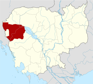
Map of Cambodia highlighting Battambang Province
|
|
| Country | |
| Provincial status | 6 December 1907 |
| Capital | Battambang Municipality |
| Area | |
| • Total | 11,702 km2 (4,518 sq mi) |
| Population
(2019)
|
|
| • Total | |
| • Density | 84/km2 (220/sq mi) |
| Time zone | UTC+7 (ICT) |
| ISO 3166 code | KH-2 |
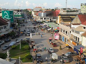
Battambang is a province (khaet) of Cambodia. Its capital and largest city is Battambang.
The Tonlé Sap Biosphere Reserve is in the province. The temples Wat Ek Phnom and Wat Banan are also here. Seventy five percent of the area is jungles and mountains. The area has a tropical climate.
Battambang is divided into 13 districts and one municipality:
- Aek Phnum
- Banan
- Battambang Municipality
- Bavel
- Kamrieng
- Koas Krala
- Moung Ruessei
- Phnum Proek
- Rotanak Mondol
- Rukhak Kiri
- Samlout
- Sampov Loun
- Sangkae
- Thma Koul
Images for kids
See also
 In Spanish: Provincia de Battambang para niños

All content from Kiddle encyclopedia articles (including the article images and facts) can be freely used under Attribution-ShareAlike license, unless stated otherwise. Cite this article:
Battambang Province Facts for Kids. Kiddle Encyclopedia.


