Ballona Creek facts for kids
Quick facts for kids Ballona Creek |
|
|---|---|
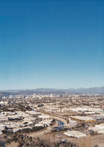
As seen from Baldwin Hills, the eastern end of Ballona creek near La Cienega Boulevard.
|
|
| Country | United States |
| State | California |
| Region | Los Angeles County |
| Cities | Los Angeles, Culver City |
| Physical characteristics | |
| Main source | Los Angeles, California 110 ft (34 m) 34°02′39″N 118°21′12″W / 34.04417°N 118.35333°W |
| River mouth | Playa del Rey - Venice, Los Angeles 0 ft (0 m) 33°57′37″N 118°27′33″W / 33.96028°N 118.45917°W |
| Basin features | |
| Tributaries |
|
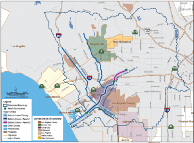
Ballona Creek (Río de La Ballona) is an 8.8-mile-long (14.2 km) urbanized river in southwestern Los Angeles County, California, whose watershed includes a portion of the western Los Angeles basin, from the Santa Monica Mountains on the north, the Harbor Freeway (I-110) on the east, and the Baldwin Hills on the south.
The urban river begins in the historical Rancho Las Cienegas, then passes into the historical Rancho La Ballona, while flowing through Culver City and suburbaninzed Del Rey before merging with the ocean at Santa Monica Bay between Marina del Rey and suburban Playa del Rey.
Contents
History
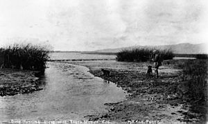
During the Pre-Columbian era, Tongva people existed as hunters and gatherers in small villages throughout the Ballona Creek watershed and other parts of the Los Angeles basin. Native American culture and land management practice was disrupted by the arrival of Spanish explorers.
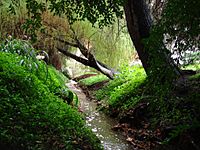
In 1769, the Tongva met their first Europeans when Portola expedition came through on its way north. Continuing west after crossing the Los Angeles River, diarist Fray Juan Crespi noted that the party "came across a grove of very large alders...from which flows a stream of water...The water flowed afterwards in a deep channel towards the southwest". Researchers identified the place as the headwaters of Ballona Creek. The explorers made camp nearby on August 3.
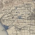
Around 1820, a mestizo rancher named Augustine Machado began grazing his cattle on the Ballona wetlands and claimed a fourteen-thousand acre Mexican land grant that stretched from modern-day Culver City to Pico Boulevard in Santa Monica, California. Ballona Creek and Lagoon are named for the Ballona or Paseo de las Carretas land grant, dated November 27, 1839. The Machado and Talamantes families, co-grantees of the rancho, heralded from Baiona in northern Spain. After the Mexican-American War followed by statehood in California History with court decisions, the Ballona land grant claims were lost, and real estate speculation, this area of Los Angeles County experienced rapid growth, with open land being transformed into agricultural use alongside small towns and new cities such as Culver City, Venice (later incorporated into Los Angeles), and Santa Monica.
Watershed and course
The Ballona Creek watershed totals about 130 square miles (340 km2). Its land use consists of 64% residential, 8% commercial, 4% industrial, and 17% open space. The major tributaries to the Ballona Creek and Estuary include Centinela Creek, Sepulveda Canyon Channel and Benedict Canyon Channel; most of the creek's minor tributaries have been destroyed by development or paved over and flow into Ballona Creek as a network of underground storm drains.
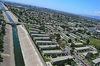
At the time of Spanish settlement, the Los Angeles River turned to the west just south of present-day Bunker Hill, joining Ballona Creek just to the west of its current channel. However, during a major flood in 1825, the Los Angeles River's course changed to its present channel, and Ballona Creek became a completely distinct waterway. Much of the above-ground section of the creek was lined with concrete as part of the flood-control project undertaken by the United States Army Corps of Engineers following the Los Angeles Flood of 1938.
Ballona Creek Watershed climate can be characterized as Mediterranean with average annual rainfall of approximately 15 inches per year over most of the developed portions of the watershed. The flow rate in the Creek varies considerably from a trickle flow of about 14 cubic feet (0.40 m3) per second during dry weather to 71,400 cubic feet (2,020 m3) per second during a 50-year storm event. Ballona Wetlands and Del Rey Lagoon are connected to the Ballona Estuary through tide gates.
Crossings and tributaries
From northern source to southern mouth (year built in parentheses):
- Begins at South Cochran Avenue
- South Burnside Avenue (1974)
- Hauser Boulevard (1974)
- Thurman Avenue (1974)
- South Fairfax Avenue (1962)
- Interstate 10 (1964)
- La Cienega Boulevard (1937)
- Washington Boulevard (1938)
- National Boulevard north (1967)
- Metro E Line (originally Santa Monica Air Line (1909))
- National Boulevard south (1967)
- Higuera Street (1938)
- Duquesne Avenue (1938)
- Overland Avenue (1938)
- Westwood Boulevard [Pedestrian Bridge to Bike Path]
- Sepulveda Boulevard (1985)
- Sawtelle Boulevard (1988)
- Interstate 405 - San Diego Freeway (1960)
- Sepulveda Channel enters
- Inglewood Boulevard (1937)
- South Centinela Avenue (1938)
- State Route 90 (1972)
- Centinela Creek enters
- Lincoln Boulevard/State Route 1 (1937)
- Culver Boulevard (1937)
- Pacific Avenue [Bridge to Bike Path]
-
Sea water flows inland at high tide two times daily every 12.5 hours several miles inland from the Pacific Ocean, to this green salt marsh at the junction of Centinela Creek (right) and Ballona Creek (left) as an urban estuary. Centinela Creek brings rainfall water from the southeastern part of the watershed, while Ballona Creek brings rainfall water from the northeastern part of the watershed.
-
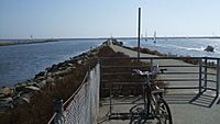
Near its end, Ballona Creek (left) runs adjacent to Marina del Rey harbor entrance (right) before both empty into the Santa Monica Bay. The Marina del Rey Breakwater can be seen in the distance spanning both the harbor entrance and the terminus of Ballona Creek
Ecology and conservation
The historical and current wetland and estuarine tidal river at the mouth of Ballona Creek occupied approximately 2,000 acres (810 ha). Although much of the wetland was drained and developed, a portion remains protected. The State of California owns 600 acres (240 ha) of the former wetlands; the CDFW (California Department of Fish and Wildlife) owns 540 acres (220 ha), and the State Lands Commission owns 60 acres (24 ha), including a newly created freshwater marsh. Much of these preserved lands are designated as the Ballona Wetlands Ecological Reserve and despite historic degradation, conditions are improving. Wetland flora includes pickleweed, marsh heather, saltgrass, salt marsh dodder, arrowgrass, glasswort, alongside a mix of native and naturalized upland plant species including coyote bush, brome, Lewis primrose, iceplant, goldenbush, oxalis, laurel sumac, and ryegrass. Bird species of special interest observed in the reserve include nesting pairs of Belding's Savannah sparrow (Passerculus rostratus/sandwichensis beldingi) and foraging use by California least terns (Sterna antillarum browni).
Pollution
The urbanization of the watershed, and associated with it the pollution of urban runoff and stormwater, has degraded the water quality in Ballona Creek and its estuary. Ballona Creek is listed by the Los Angeles Regional Water Quality Control Board impaired for fecal coliform, heavy metals, and pesticides. Dry weather urban runoff and storm water, both conveyed by storm drains, are the primary sources of pollution in the riverine coastal estuary.
Recreation
Many national, historical, archeological and cultural landmarks, tourist attractions, educational institutions, businesses and industries exist in Ballona Creek Watershed. The Ballona creek bicycle path that extends almost 7 miles (11 km) from National Boulevard in Culver City to the end of Ballona Creek Estuary provides opportunities for recreation in the area. Birdwatching is popular.
In popular culture
In the 1997 movie Volcano, Mike Roark (Tommy Lee Jones) dropped a 20-story apartment building in a controlled demolition in order to divert a flowing river of lava into Ballona Creek and thus into the Pacific Ocean.
Images for kids
-
Three bridges over Ballona Creek: Expo Line Bikeway (formerly National Blvd. north) to the left, E Line track overhead, and long-derelict Pacific Electric Santa Monica Air Line route to the right; with bypassing jogger on Ballona Creek Bike Path below.
-
Ballona Creek, view of north levee from south levee, 1942; note oil drilling platforms on the right, where Marina Del Rey and Ballona Lagoon are located today.


