Baker Island facts for kids

Baker Island
|
|

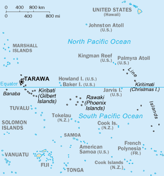
Map of the central Pacific Ocean showing Baker Island and nearby Howland Island just north of the equator and east of Tarawa.
|
|
| Geography | |
|---|---|
| Coordinates | 0°11′41″N 176°28′46″W / 0.19472°N 176.47944°W |
| Area | 1.64 km2 (0.63 sq mi) |
| Highest elevation | 8 m (26 ft) |
| Administration | |
| Demographics | |
| Population | 0 |
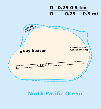
Baker Island is a small coral island, or atoll, in the North Pacific Ocean. It is just above the equator. It belongs to the United States. The United States Department of the Interior is in charge of the island. It is called the Baker Island National Wildlife Refuge.
The island has no trees. The island is surrounded by a coral reef. This makes the atoll hard to approach in a boat.
Contents
Gallery
Related pages
Images for kids
See also
 In Spanish: Isla Baker para niños

All content from Kiddle encyclopedia articles (including the article images and facts) can be freely used under Attribution-ShareAlike license, unless stated otherwise. Cite this article:
Baker Island Facts for Kids. Kiddle Encyclopedia.


