Amund Ringnes Island facts for kids

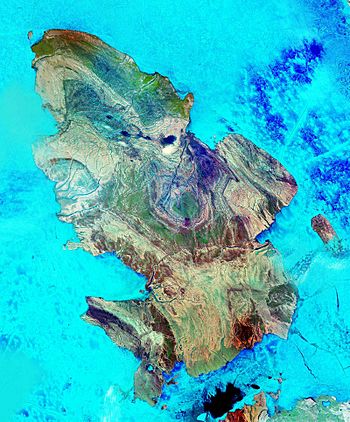
Amund Ringnes Island from space
|
|
 |
|
| Geography | |
|---|---|
| Location | Arctic Ocean |
| Coordinates | 78°20′N 96°25′W / 78.333°N 96.417°W |
| Archipelago | Sverdrup Islands Queen Elizabeth Islands Canadian Arctic Archipelago |
| Area | 5,255 km2 (2,029 sq mi) |
| Highest elevation | 265 m (869 ft) |
| Highest point | Un-named ridge feature northeast inland from Andersen Bay |
| Administration | |
| Territory | Nunavut |
| Region | Qikiqtaaluk |
| Demographics | |
| Population | Uninhabited |
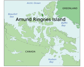
Amund Ringnes Island is one of the Sverdrup Islands in the Qikiqtaaluk Region, Nunavut, Canada. It is located in the Arctic Ocean, between 78 and 79 degrees of latitude. It lies east of Ellef Ringnes Island, west of Axel Heiberg Island. Hassel Sound separates Amund Ringnes Island from Ellef Ringnes Island. Hendriksen Strait is to the south, as is Cornwall Island. Norwegian Bay is to the east, as is Haig-Thomas Island. To the north lies Peary Channel.
The island has an area of 5,255 km2 (2,029 sq mi) in size, making it the 111th largest island in the world, and Canada's 25th largest island.
The island was named by Otto Sverdrup for Oslo brewer Amund Ringnes, one of the sponsors of his expedition. He first sighted it in 1900. The island was claimed by Norway from 1902 until the claim was relinquished in 1930.
External sources
See also
 In Spanish: Isla Amund Ringnes para niños


