Aasgard Pass facts for kids
Quick facts for kids Aasgard Pass |
|
|---|---|

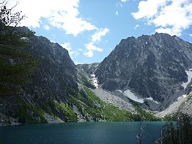
Aasgard Pass, viewed from the northwest across Colchuck Lake
|
|
| Elevation | 7,841 ft (2,390 m) |
| Traversed by | Unmaintained United States Forest Service foot trail |
| Location | Chelan County, Washington, US |
| Range | Stuart Range, in the Cascades |
| Coordinates | 47°28′49″N 120°49′14″W / 47.48028°N 120.82056°W |
Aasgard Pass, officially identified as Colchuck Pass, (elevation 7,841 feet (2,390 m)) is a mountain pass on the east side of the Cascades in Washington's Alpine Lakes Wilderness southwest of Leavenworth. It is the shorter and steeper of two primary hiking routes into the Enchantments, one of Washington's most popular hiking areas. It separates Colchuck Lake (elevation 5,570 feet (1,700 m)) to the northwest from the Upper Enchantment Basin (elevation ~7,500 feet (2,300 m)) to the southeast. Aasgard Pass is located at the saddle between Dragontail Peak and the Enchantment Peaks.
Attempts to change the name officially in 1967 and 1988 were both turned down by the US Board on Geographic Names; thus, the name "Colchuck Pass" is retained on United States Geological Survey (USGS) maps. Mountaineers have long referred to the feature as Aasgard Pass, the name favored by famed climber and guide author Fred Beckey. The name was likely coined by Bill and Peggy Stark, who explored the Enchantments extensively in the mid-20th Century, and who gave Nordic mythological names to many of the lakes that previously had been named by A. H. Sylvester, a U.S. Geological Survey topographer supervisor of Wenatchee National Forest in the early 1900s who is credited with discovering the region. The official naming rulings of the US Board in the 1960s resulted in a mixture of the two name sets being adopted as official. The current policy of not adopting new names for geographic features in wilderness areas probably precludes the rest of the names identified by the Starks from ever achieving official status.

