1811-12 New Madrid Earthquake facts for kids

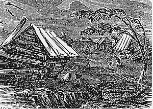
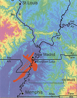
A number of earthquakes that happened near the town of New Madrid, in late 1811, and early 1812 are known as the 1811–12 New Madrid earthquakes today. The first of these happened December 16, 1811. It probably had a magnitude of 7.5-7.9 on the Richter scale. There also was an aftershock of magnitude 7.4 on the same day. Until 2018, they are the most powerful earthquakes to hit the contiguous United States east of the Rocky Mountains in recorded history. The earthquakes and the seismic zone of occurrence are named for the Mississippi River town of New Madrid. The town was part of the Louisiana Territory at the time. Today, it is in the US state of Missouri.
There are estimates that these stable continental region earthquakes were felt strongly over roughly 130,000 square kilometers (50,000 sq mi), and moderately across nearly 3 million square kilometers (1 million square miles). The 1906 San Francisco earthquake, by comparison, was felt moderately over roughly 16,000 km2 (6,200 sq mi).
Different American Indian tribes interpreted these earthquakes, and came to a consensus: the powerful earthquake had to have meant something. For many tribes in Tecumseh's pan-Indian alliance, it meant that Tecumseh and his brother the Prophet must be supported.
Even today, earthquakes happen in this area, known as New Madrid Seismic Zone (or NMSZ). Scientists estimate, that until 2050, there is a chace of over 90%, that quake with a magnitude of over 7.0 on the Richter scale occurs there. Arthur C. Clarke has written a story, called Richter 10, where he describes this scenario.


