Zubillaga facts for kids
Quick facts for kids
Zubillaga
|
|
|---|---|

Zubillaga (Lantarón, Àlava)
|
|
| Lua error in Module:Location_map at line 416: Malformed coordinates value. | |
| Country | Spain |
| Autonomous community | Basque Country |
| Province | Álava |
| Comarca | Añana |
| Municipality | Lantarón |
| Area | |
| • Total | 0.47 km2 (0.18 sq mi) |
| Elevation | 460 m (1,510 ft) |
| Population
(2023)
|
|
| • Total | 109 |
| • Density | 232/km2 (601/sq mi) |
| Postal code |
01213
|
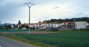
Zubillaga (Spanish pronunciation: [θuβiˈʝaɣa], Basque pronunciation: [s̻uβiʎaɣa]) is a village and concejo located in the municipality of Lantarón, in Álava province, Basque Country, Spain. It was established in the late 1940s as a neighborhood for the workers of a nearby chemical plant. It acquired its current name in 1989, when it was segregated from Comunión.

All content from Kiddle encyclopedia articles (including the article images and facts) can be freely used under Attribution-ShareAlike license, unless stated otherwise. Cite this article:
Zubillaga Facts for Kids. Kiddle Encyclopedia.
