Zacualtipán facts for kids
Quick facts for kids
Zacualtipán de Ángeles
|
||
|---|---|---|
|
Municipality and town
|
||
 |
||
|
||
| Country | ||
| State | ||
| Municipal seat | ||
| Area | ||
| • Total | 241.6 km2 (93.3 sq mi) | |
| Population
(2020)
|
||
| • Total | 38,155 | |
| Time zone | UTC-6 (Zona Centro) | |
| Postal code |
43200–43225
|
|
| Website | zacualtipan.hidalgo.gob.mx | |
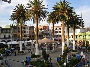
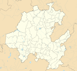
Zacualtipán (formally: Zacualtipán de Ángeles, for Felipe Ángeles, born there in 1868) is a town and one of the 84 municipalities of Hidalgo, in central-eastern Mexico. The municipality covers an area of 241.6 km2.
In 2020, the municipality had a total population of 38,155, up from 25,987 in 2005.
History
The town of Zacualtipán was the site of the action of Sequalteplan on February 25, 1848. It was a surprise attack by a mounted American force under Gen. Joseph Lane that defeated a Mexican guerrilla force under Celedonio Dómeco de Jarauta during the Mexican–American War.
Geography
Climate
| Climate data for Zacualtipan | |||||||||||||
|---|---|---|---|---|---|---|---|---|---|---|---|---|---|
| Month | Jan | Feb | Mar | Apr | May | Jun | Jul | Aug | Sep | Oct | Nov | Dec | Year |
| Mean daily maximum °C (°F) | 16.5 (61.7) |
18.1 (64.6) |
21.4 (70.5) |
23.6 (74.5) |
24.3 (75.7) |
22 (72) |
20.3 (68.5) |
20.8 (69.4) |
19.6 (67.3) |
18.5 (65.3) |
17.6 (63.7) |
16.8 (62.2) |
20 (68) |
| Mean daily minimum °C (°F) | 2.3 (36.1) |
3.2 (37.8) |
5.3 (41.5) |
7.3 (45.1) |
8.5 (47.3) |
8.8 (47.8) |
8.1 (46.6) |
8.1 (46.6) |
7.9 (46.2) |
6 (43) |
4.0 (39.2) |
2.7 (36.9) |
6.0 (42.8) |
| Average precipitation mm (inches) | 41 (1.6) |
30 (1.2) |
33 (1.3) |
48 (1.9) |
66 (2.6) |
200 (7.8) |
210 (8.1) |
200 (8) |
370 (14.4) |
210 (8.2) |
89 (3.5) |
38 (1.5) |
1,530 (60.1) |
| Source: Weatherbase | |||||||||||||

All content from Kiddle encyclopedia articles (including the article images and facts) can be freely used under Attribution-ShareAlike license, unless stated otherwise. Cite this article:
Zacualtipán Facts for Kids. Kiddle Encyclopedia.


