Woolmar, Queensland facts for kids
Quick facts for kids WoolmarQueensland |
|||||||||||||||
|---|---|---|---|---|---|---|---|---|---|---|---|---|---|---|---|

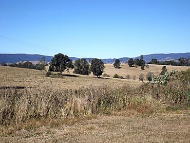
Esk Kilcoy Road, 2015
|
|||||||||||||||
| Population | 565 (2021 census) | ||||||||||||||
| • Density | 8.321/km2 (21.55/sq mi) | ||||||||||||||
| Postcode(s) | 4515 | ||||||||||||||
| Area | 67.9 km2 (26.2 sq mi) | ||||||||||||||
| Time zone | AEST (UTC+10:00) | ||||||||||||||
| Location | |||||||||||||||
| LGA(s) | Somerset Region | ||||||||||||||
| State electorate(s) | Nanango | ||||||||||||||
| Federal Division(s) | Blair | ||||||||||||||
|
|||||||||||||||
Woolmar is a rural locality in the Somerset Region, Queensland, Australia. In the 2021 census, Woolmar had a population of 565 people.
Contents
Geography
Woolmar is immediately west of Kilcoy.
Kilcoy Creek marks a small section of the eastern boundary. In the west elevated terrain reaches higher than 400 metres above sea level.
The D'Aguilar Highway passes through Woolmar.
History
Woolmar Provisional School opened on 8 March 1894. On 1 January 1909, it became Woolmar State School. It had temporary closures in 1931 and 1940, closing permanently on 14 April 1941. It was at 5615 D'Aguilar Highway (26°56′45″S 152°31′21″E / 26.9458°S 152.5224°E).
Gregor's Creek Provisional School opened on 14 February 1896. On 1 January 1909, it became Gregor's Creek State School. It closed in December 1963. It was at 1095 Gregors Creek Road (26°57′36″S 152°26′33″E / 26.96012°S 152.44259°E), now in Woolmar.
Demographics
In the 2016 census, Woolmar had a population of 421 people.
In the 2021 census, Woolmar had a population of 565 people.
Education
There are no schools in Woolmar. The nearest government primary and secondary schools are Kilcoy State School and Kilcoy State High School in neighbouring Kilcoy to the east.
Amenities
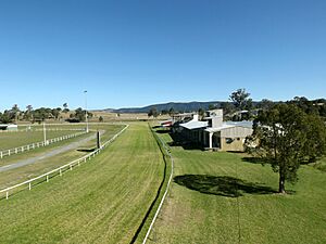
The Kilcoy Showgrounds and Racecourse are at 26 Showgrounds Road in Woolmar (26°56′34″S 152°32′57″E / 26.9427°S 152.54904°E).
Kilcoy General Cemetery is on the western corner of the D'Aguilar Highway and Esk Kilcoy Road (26°56′44″S 152°32′35″E / 26.9455°S 152.5431°E).


