Wondalga, New South Wales facts for kids
Quick facts for kids WondalgaNew South Wales |
|
|---|---|

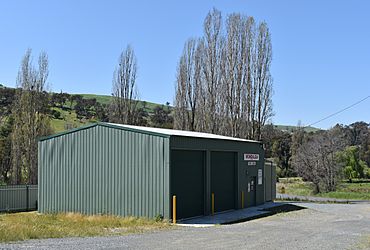
Wondalga RFS shed, 2020
|
|
| Population | 100 (2016 census) |
| Postcode(s) | 2729 |
| Elevation | 361 m (1,184 ft) |
| Location | |
| LGA(s) | Snowy Valleys Council |
| County | Wynyard |
| State electorate(s) | Wagga Wagga |
| Federal Division(s) | Eden-Monaro |
Wondalga is a rural community in the central east part of the Riverina and situated about 14 kilometres (8.7 mi) north of Batlow and 16 kilometres (9.9 mi) south of Adelong.
Middle Adelong Post Office opened on 1 August 1875, was renamed Wondalga in 1908 and closed in 1971.

All content from Kiddle encyclopedia articles (including the article images and facts) can be freely used under Attribution-ShareAlike license, unless stated otherwise. Cite this article:
Wondalga, New South Wales Facts for Kids. Kiddle Encyclopedia.
