Wonalancet River facts for kids
Quick facts for kids Wonalancet River |
|
|---|---|

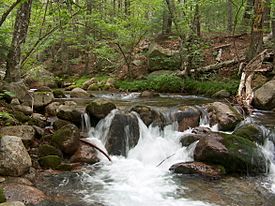
The Wonalancet River near its source in the Sandwich Range
|
|
| Country | United States |
| State | New Hampshire |
| Counties | Grafton, Carroll |
| Towns | Waterville Valley, Sandwich, Albany, Tamworth |
| Physical characteristics | |
| Main source | Sandwich Range White Mountain National Forest 2,320 ft (710 m) 42°56′34″N 71°23′38″W / 42.94278°N 71.39389°W |
| River mouth | Swift River Tamworth 740 ft (230 m) 43°53′39″N 71°17′47″W / 43.89417°N 71.29639°W |
| Length | 7.6 mi (12.2 km) |
| Basin features | |
| Tributaries |
|
The Wonalancet River is a 7.6-mile-long (12.2 km) river in the White Mountains of New Hampshire in the United States. Named after the 17th-century Pennacook sachem Wonalancet, it is a tributary of the southern Swift River, part of the Bearcamp River / Ossipee Lake / Saco River watershed leading to the Atlantic Ocean.
The Wonalancet River rises in the heart of the Sandwich Range, in "The Bowl", a forested glacial cirque lying between Mount Whiteface to the west, Mount Passaconaway to the north, and Mount Wonalancet to the east. The river flows south, paralleled by the Dicey Mill Trail, out of the mountains into the communities of Ferncroft, in the southwest corner of the town of Albany, and Wonalancet, in the northwest corner of the town of Tamworth. The river continues east into a forested valley and joins the Swift River 3 miles (5 km) northwest of Tamworth village.


