Winterville, Georgia facts for kids
Quick facts for kids
Winterville, Georgia
|
||
|---|---|---|
|
||
| Nickname(s):
The Marigold Capital of Georgia, the Friendship City
|
||

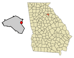
Location in Clarke County and the state of Georgia
|
||
| Country | United States | |
| State | Georgia | |
| County | Clarke | |
| Incorporated | 1904 | |
| Area | ||
| • Total | 2.65 sq mi (6.85 km2) | |
| • Land | 2.62 sq mi (6.78 km2) | |
| • Water | 0.03 sq mi (0.07 km2) | |
| Elevation | 797 ft (243 m) | |
| Population
(2020)
|
||
| • Total | 1,201 | |
| • Density | 458.40/sq mi (177.01/km2) | |
| Time zone | UTC-5 (Eastern (EST)) | |
| • Summer (DST) | UTC-4 (EDT) | |
| ZIP code |
30683
|
|
| Area code(s) | 706 | |
| FIPS code | 13-83728 | |
| GNIS feature ID | 2405776 | |
Winterville is a city in Clarke County, Georgia, United States. The population was 1,201 at the 2020 census.
History
The community was named after John Winter, a railroad official. Winterville was incorporated in 1904.
Since 1991, when the City of Athens dissolved its city charter to form the unified government of Athens-Clarke County, Winterville has been the only municipality located wholly within Athens-Clarke County.
As of 2024, Athens-Clarke County has converted 1.1 miles (1.8 km) of the abandoned Athens-to—Savannah railroad spur into a paved walking trail titled "Firefly Trail". It will eventually connect to the Georgia Hi–Lo Trail, which will become the longest paved trail and longest arboretum in the United States.
Geography
Winterville is located at 33°58′00″N 83°16′54″W / 33.966720°N 83.281669°W, a 6-mile (10 km)–drive from the University of Georgia. According to the United States Census Bureau, the city has a total area of 2.7 square miles (7.0 km2), all land.
Climate
| Climate data for Winterville, Georgia, 1991–2020 normals, extremes 1999–2021 | |||||||||||||
|---|---|---|---|---|---|---|---|---|---|---|---|---|---|
| Month | Jan | Feb | Mar | Apr | May | Jun | Jul | Aug | Sep | Oct | Nov | Dec | Year |
| Record high °F (°C) | 79 (26) |
80 (27) |
89 (32) |
91 (33) |
98 (37) |
107 (42) |
106 (41) |
101 (38) |
97 (36) |
97 (36) |
83 (28) |
78 (26) |
107 (42) |
| Mean maximum °F (°C) | 70.3 (21.3) |
74.7 (23.7) |
83.2 (28.4) |
85.9 (29.9) |
89.3 (31.8) |
95.3 (35.2) |
95.2 (35.1) |
94.5 (34.7) |
90.9 (32.7) |
84.7 (29.3) |
76.9 (24.9) |
72.7 (22.6) |
97.0 (36.1) |
| Mean daily maximum °F (°C) | 54.0 (12.2) |
57.7 (14.3) |
66.3 (19.1) |
73.7 (23.2) |
79.6 (26.4) |
85.4 (29.7) |
88.3 (31.3) |
87.1 (30.6) |
82.0 (27.8) |
72.9 (22.7) |
63.1 (17.3) |
55.9 (13.3) |
72.2 (22.3) |
| Daily mean °F (°C) | 41.8 (5.4) |
45.1 (7.3) |
52.5 (11.4) |
60.2 (15.7) |
67.3 (19.6) |
74.5 (23.6) |
77.8 (25.4) |
76.8 (24.9) |
71.2 (21.8) |
60.6 (15.9) |
50.6 (10.3) |
44.1 (6.7) |
60.2 (15.7) |
| Mean daily minimum °F (°C) | 29.5 (−1.4) |
32.5 (0.3) |
38.7 (3.7) |
46.7 (8.2) |
55.0 (12.8) |
63.7 (17.6) |
67.2 (19.6) |
66.5 (19.2) |
60.4 (15.8) |
48.3 (9.1) |
38.0 (3.3) |
32.3 (0.2) |
48.2 (9.0) |
| Mean minimum °F (°C) | 16.7 (−8.5) |
21.1 (−6.1) |
25.9 (−3.4) |
33.3 (0.7) |
43.1 (6.2) |
56.9 (13.8) |
60.9 (16.1) |
61.3 (16.3) |
50.5 (10.3) |
35.5 (1.9) |
26.0 (−3.3) |
22.3 (−5.4) |
15.6 (−9.1) |
| Record low °F (°C) | 7 (−14) |
13 (−11) |
19 (−7) |
25 (−4) |
37 (3) |
45 (7) |
55 (13) |
55 (13) |
39 (4) |
27 (−3) |
18 (−8) |
14 (−10) |
7 (−14) |
| Average precipitation inches (mm) | 4.76 (121) |
4.73 (120) |
4.78 (121) |
3.65 (93) |
3.93 (100) |
4.62 (117) |
4.32 (110) |
4.77 (121) |
4.34 (110) |
3.32 (84) |
3.85 (98) |
4.71 (120) |
51.78 (1,315) |
| Average snowfall inches (cm) | 0.1 (0.25) |
0.4 (1.0) |
0.0 (0.0) |
0.0 (0.0) |
0.0 (0.0) |
0.0 (0.0) |
0.0 (0.0) |
0.0 (0.0) |
0.0 (0.0) |
0.0 (0.0) |
0.0 (0.0) |
0.1 (0.25) |
0.6 (1.5) |
| Average precipitation days (≥ 0.01 in) | 10.1 | 10.3 | 10.3 | 8.5 | 8.3 | 10.8 | 10.9 | 9.6 | 7.9 | 6.5 | 8.2 | 10.6 | 112.0 |
| Average snowy days (≥ 0.1 in) | 0.2 | 0.4 | 0.1 | 0.0 | 0.0 | 0.0 | 0.0 | 0.0 | 0.0 | 0.0 | 0.0 | 0.1 | 0.8 |
| Source 1: NOAA | |||||||||||||
| Source 2: National Weather Service (mean maxima/minima 2006–2020) | |||||||||||||
Demographics
| Historical population | |||
|---|---|---|---|
| Census | Pop. | %± | |
| 1910 | 465 | — | |
| 1920 | 504 | 8.4% | |
| 1930 | 432 | −14.3% | |
| 1940 | 503 | 16.4% | |
| 1950 | 453 | −9.9% | |
| 1960 | 497 | 9.7% | |
| 1970 | 551 | 10.9% | |
| 1980 | 621 | 12.7% | |
| 1990 | 876 | 41.1% | |
| 2000 | 1,068 | 21.9% | |
| 2010 | 1,122 | 5.1% | |
| 2020 | 1,201 | 7.0% | |
| U.S. Decennial Census | |||
| Race | Num. | Perc. |
|---|---|---|
| White (non-Hispanic) | 832 | 69.28% |
| Black or African American (non-Hispanic) | 220 | 18.32% |
| Asian | 21 | 1.75% |
| Pacific Islander | 1 | 0.08% |
| Other/Mixed | 46 | 3.83% |
| Hispanic or Latino | 81 | 6.74% |
As of the 2020 United States census, there were 1,201 people, 449 households, and 331 families residing in the city.
Amenities
Winterville's Marigold Auditorium for Arts and Culture, built in 1953, fell into disrepair later in the 20th century. It has since been renovated. The original auditorium burned down on its opening night in the early 1900s.
The village's Cultural Center is located in the former high-school building, built in 1956. The original high school was built at the same time as the auditorium.
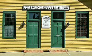
Winterville Community Center is located in a former Georgia Railroad train depot, which was built in the late 19th century.
See also
 In Spanish: Winterville (Georgia) para niños


