Wilson Peak facts for kids
Quick facts for kids Wilson Peak |
|
|---|---|

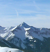
Wilson peak photographed from the Telluride Ski Resort
|
|
| Highest point | |
| Elevation | 14,023 ft (4,274 m) |
| Prominence | 857 ft (261 m) |
| Isolation | 1.51 mi (2.43 km) |
| Listing |
|
| Geography | |
| Location | High point of San Miguel County, Colorado, United States |
| Parent range | San Miguel Mountains |
| Topo map | USGS 7.5' topographic map Mount Wilson, Colorado |
| Climbing | |
| Easiest route | Southwest ridge from Silver Pick or Navajo Basins |
Wilson Peak is a 14,023-foot (4,274 m) mountain peak in the U.S. state of Colorado. It is located in the Lizard Head Wilderness of the Uncompahgre National Forest, in the northwestern San Juan Mountains. It is the highest point in San Miguel County.
The mountain was named for A.D. Wilson, the chief topographer with the Hayden Survey. Nearby Mount Wilson also honors him.
Geography
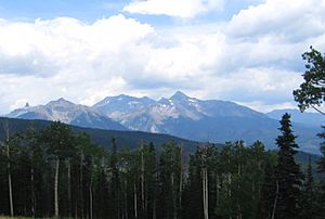
Wilson Peak is in the western part of the San Juan Mountains. The western San Juans are also known as the San Miguel Mountains or the Wilson Massif. Two additional fourteen thousand foot peaks are within 2 miles (3 km) of its summit: Mount Wilson (14,256 feet (4,345 m)) and El Diente Peak (14,159 feet (4,316 m)). Gladstone Peak (13,913 feet (4,241 m)) is located on the ridge between Wilson Peak and Mount Wilson.

Recreation
Wilson Peak is climbed by hundreds each year, primarily in summer months, but winter ascents are not unusual and sometimes serve as the beginning of backcountry skiing descents. Summer ascents of the peak are considered Class 3 technical climbs, meaning that scrambling over rock is required (with hand holds being used for balance) and ropes typically not employed.
The easiest route begins at the Rock of Ages Trailhead (elevation 10,350 feet (3,150 m)) located 18 miles (29 km) west of Telluride, Colorado. Forest Trail 429 climbs southeast through Silver Pick Basin to the Rock of Ages Saddle (between Silver Pick and Navajo Basins) at 13,100 feet (3,990 m). Forest Trail 408 is then followed east to 13,200 feet (4,020 m) on the saddle between Gladstone and Wilson Peaks before the ridge is climbed northeast to the summit. Round trip distance is 10 miles (16 km).


