Whitesboro, Texas facts for kids
Quick facts for kids
Whitesboro, Texas
|
|
|---|---|

Downtown Whitesboro
|
|

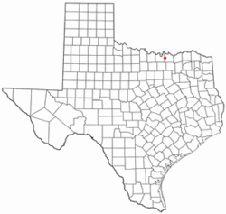
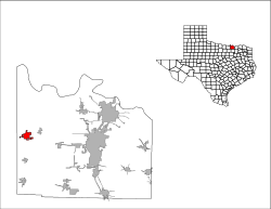
Location of Whitesboro, Texas
|
|
 |
|
| Country | United States |
| State | Texas |
| County | Grayson |
| Area | |
| • Total | 3.34 sq mi (8.66 km2) |
| • Land | 3.34 sq mi (8.64 km2) |
| • Water | 0.01 sq mi (0.02 km2) |
| Elevation | 781 ft (238 m) |
| Population
(2020)
|
|
| • Total | 4,074 |
| • Density | 1,219.8/sq mi (470.4/km2) |
| Time zone | UTC-6 (Central (CST)) |
| • Summer (DST) | UTC-5 (CDT) |
| ZIP code |
76273
|
| Area code(s) | 903, 430 |
| FIPS code | 48-78532 |
| GNIS feature ID | 2412259 |
Whitesboro is a city in Grayson County, Texas, United States. The population was 4,074 at the 2020 census. Whitesboro is named for its founder, Ambrose B. White.
It is part of the Sherman-Denison metropolitan area.
History
The area was once known as "Wolfpath". The first settler in the area was Robert Diamond, but the settlement of Wolfpath began with the arrival of Ambrose B. White and his family in 1848. The Butterfield Overland Mail route used White's Westview Inn as the "Diamond Station" on its trail from the Mississippi River to the Pacific Coast from 1858 to 1861. A post office, under the name "Whitesborough", began operations there in 1860.
After the Civil War, Whitesborough grew into a frontier town where female residents were prohibited from leaving their homes on Saturday nights because shootings were so common. Whitesborough had a population of 500, saloons, several stores, and other businesses when it was incorporated on June 2, 1873. By 1879, it had a bank, a newspaper, and train service from Denison on a line from the Missouri, Kansas and Texas Railroad. In 1887, it altered the spelling of its name to "Whitesboro".
Geography
Whitesboro is located in western Grayson County at 33°39′35″N 96°54′22″W / 33.65972°N 96.90611°W (33.659612, -96.905999). U.S. Route 82 passes through the north side of the city, and U.S. Route 377 passes through the east side. US 82 leads east 17 miles (27 km) to Sherman, the county seat, and west 13 miles (21 km) to Gainesville, while US 377 leads north 15 miles (24 km) to the Oklahoma border on the Red River and south 41 miles (66 km) to Denton.
According to the United States Census Bureau, Whitesboro has a total area of 3.3 square miles (8.6 km2), of which 0.006 square miles (0.015 km2), or 0.18%, are water.
Demographics
| Historical population | |||
|---|---|---|---|
| Census | Pop. | %± | |
| 1880 | 773 | — | |
| 1890 | 1,170 | 51.4% | |
| 1900 | 1,243 | 6.2% | |
| 1910 | 1,219 | −1.9% | |
| 1920 | 1,810 | 48.5% | |
| 1930 | 1,535 | −15.2% | |
| 1940 | 1,560 | 1.6% | |
| 1950 | 1,854 | 18.8% | |
| 1960 | 2,485 | 34.0% | |
| 1970 | 2,927 | 17.8% | |
| 1980 | 3,197 | 9.2% | |
| 1990 | 3,209 | 0.4% | |
| 2000 | 3,760 | 17.2% | |
| 2010 | 3,793 | 0.9% | |
| 2020 | 4,074 | 7.4% | |
| U.S. Decennial Census | |||
| Race | Number | Percentage |
|---|---|---|
| White (NH) | 3,202 | 78.6% |
| Black or African American (NH) | 33 | 0.79% |
| Native American or Alaska Native (NH) | 40 | 0.98% |
| Asian (NH) | 30 | 0.74% |
| Some Other Race (NH) | 8 | 0.2% |
| Mixed/Multi-Racial (NH) | 279 | 6.85% |
| Hispanic or Latino | 483 | 11.86% |
| Total | 4,074 |
As of the 2020 United States census, there were 4,074 people, 1,593 households, and 1,065 families residing in the city.
Education
The city is served by the Whitesboro Independent School District.
Notable people
- Rayford Barnes (1920–2000), actor
- Etta Gray (1880–1970), physician
- Lydia Starr McPherson (1827–1903), founded Whitesboro Democrat newspaper in the late 1870s
- Jared L. Patterson, member of the Texas House of Representatives
- Ray Renfro, professional football player
- Grizzly Smith, professional wrestler
See also
 In Spanish: Whitesboro (Texas) para niños

