Western Victorian Volcanic Plains facts for kids
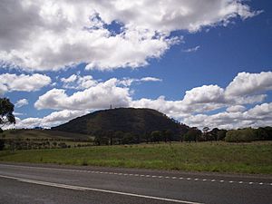
The Western Victorian Volcanic Plains in Victoria, Australia, also known as the Newer Volcanic Province, are the third largest volcanic plains in world. The biggest is the Deccan Plateau in India and the Snake River Plateau in the USA. The Western Victorian Volcanic Plains cover an area of 2.3 million hectares, more than 10% of the state. The basalt plains were formed by volcanoes over the last 6 million years with the most recent eruption being at Mount Napier 7,200 years ago. There are only a few rivers which flow across the plains, these are the Barwon, Hopkins, Leigh, Maribyrnong, Wannon and Werribee Rivers and the Mount Emu Creek. More than 90% of the plains have been cleared for farming. Over 400 volcano sites have been found on the plains. Near Ballarat the volcanoes are quite close together. The plains have built up over time with many small lava flows. The average depth of the lava is about 60 metres. Many of the features are stand out on the flat plains.
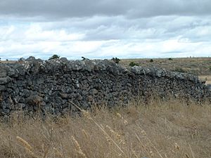
The Australian Aborigines must have seen some of the eruptions as they told stories about rocks and fires coming from some mountains. Stone tools have been found buried in volcanic ash near Warrnambool. Major Thomas Mitchell was the first European to describe the Western Volcanic Plains. He climbed Mount Napier in 1836 and wrote that it looked as if the volcano had been active not that long ago. Early settlers liked the plains as they could easily grow crops in the rich, fertile soil. They used the volcanic stones to build dry stone walls around their farms.
The Western Victorian Volcanic Plains have been quiet for thousands of years. There have been no earthquakes, no hot springs or other signs of activity. It is not known why the volcanos stopped, and some scientists believe that the volcanos on the plains are not extinct, but dormant.
Volcanic features
- Bald Hill, north of Craigieburn
- Blue Mount
- Brocks Monument
- Camel's Hump
- Granville Hill
- Green Hill, near Wallan
- Green Hill near Buninyong
- Green Hill near Pootilla
- Green Hill near Snake Valley
- Hanging Rock
- Happy Valley
- Hardie Hill
- Hayes Hill near Donnybrook
- The Jim Jim
- Lake Bullenmerri
- Lake Keilambete
- Lake Purrumbete
- Lake Terang
- Larundel Hill
- Magnet Hill (45 metres)
- Melbourne Hill (75 metres)
- Mount Aitken
- Mount Blackwood
- Mount Bullengarook
- Mount Buninyong
- Mount Cotterell
- Mount Eccles
- Mount Elephant
- Mount Franklin
- Mount Fraser (120 metres)
- Mount Gisborne (100 metres)
- Mount Hamilton
- Mount Holden (75 metres)
- Mount Kooroocheang
- Mount Koroit (60 metres)
- Mount Lawaluk
- Mount Leura
- Mount Mercer
- Mount Moorookyle
- Mount Napier
- Mount Noorat
- Mount Pisgah
- Mount Porndon (278 metres)
- Mount Rouse
- Mount Rowan (Victoria)
- Mount Shadwell
- Mount Warrenheip
- Mount Widderin
- Organ Pipes
- Pretty Sally Hill
- Red Rock near Alvie
- Red Rock near Gisborne
- Tower Hill
- Wallinduc Hill
Related pages


