Westerdale, Highland facts for kids
Quick facts for kids Westerdale
|
|
|---|---|
 Dale Mill at Westerdale, seen through Westerdale Bridge |
|
| OS grid reference | ND128519 |
| Council area | |
| Lieutenancy area | |
| Country | Scotland |
| Sovereign state | United Kingdom |
| Post town | HALKIRK |
| Postcode district | KW12 |
| Dialling code | 01847 |
| Police | Northern |
| Fire | Highlands and Islands |
| Ambulance | Scottish |
| EU Parliament | Scotland |
| UK Parliament |
|
| Scottish Parliament |
|
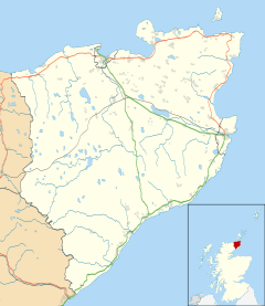
Westerdale (Scottish Gaelic: An Dail Shuas) is a scattered crofting village which lies on the River Thurso, located five miles (eight kilometres) directly south of Halkirk, in Caithness, Highland, Scotland. The B870 road passes through the village.
The 14th century Dirlot Castle is located three miles (five kilometres) south of the village, and was the stronghold of the Sutherlands, Cheynes, Gunns and Mackays throughout its history.

All content from Kiddle encyclopedia articles (including the article images and facts) can be freely used under Attribution-ShareAlike license, unless stated otherwise. Cite this article:
Westerdale, Highland Facts for Kids. Kiddle Encyclopedia.

