West Peak (Madison County, Montana) facts for kids
Quick facts for kids West Peak |
|
|---|---|

West Peak (center) near Table Mountain
|
|
| Highest point | |
| Elevation | 9,659 feet (2,944 m) |
| Geography | |
| Parent range | Highland Mountains |
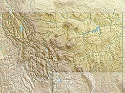
West Peak, el. 9,659 feet (2,944 m), is a mountain peak in the Highland Mountains in Madison County, Montana. It rises due west from Table Mountain in the same range. The peak is located in the Deerlodge National Forest. The headwaters of Hell's Canyon Creek, a significant tributary of the Jefferson River flow off the southeast face of the peak.

All content from Kiddle encyclopedia articles (including the article images and facts) can be freely used under Attribution-ShareAlike license, unless stated otherwise. Cite this article:
West Peak (Madison County, Montana) Facts for Kids. Kiddle Encyclopedia.

