West Jefferson, Ohio facts for kids
Quick facts for kids
West Jefferson, Ohio
|
|||
|---|---|---|---|
|
Village
|
|||

|
|||
|
|||

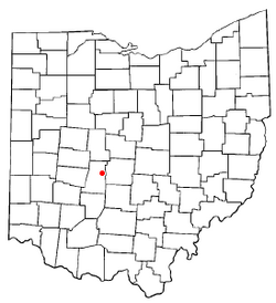
Location of West Jefferson, Ohio
|
|||

Location of West Jefferson in Madison County
|
|||
| Country | United States | ||
| State | Ohio | ||
| County | Madison | ||
| Area | |||
| • Total | 9.94 sq mi (25.74 km2) | ||
| • Land | 9.92 sq mi (25.69 km2) | ||
| • Water | 0.02 sq mi (0.05 km2) | ||
| Elevation | 971 ft (296 m) | ||
| Population
(2020)
|
|||
| • Total | 4,137 | ||
| • Density | 417.12/sq mi (161.04/km2) | ||
| Time zone | UTC-5 (Eastern (EST)) | ||
| • Summer (DST) | UTC-4 (EDT) | ||
| ZIP code |
43162
|
||
| Area code(s) | 614 and 380 | ||
| FIPS code | 39-83580 | ||
| GNIS feature ID | 2400132 | ||
West Jefferson is a village in Madison County, Ohio, United States. The population was 4,137 at the 2020 census. Located along U.S. Route 40, the village has a fairly close relationship with the surrounding township, which include various out-of-corporation-limit neighborhoods (including Haymarket Road, Olmstead Road, Forrest Lake Estates, Goodson Road/Enchanted Valley, and North and South Road).
Contents
History
West Jefferson was originally called New Hampton, and under the latter name was platted c. 1831. A post office called West Jefferson has been in operation since 1833.
Geography
According to the United States Census Bureau, the village has a total area of 4.87 square miles (12.61 km2), of which 4.85 square miles (12.56 km2) is land and 0.02 square miles (0.05 km2) is water.
Demographics
| Historical population | |||
|---|---|---|---|
| Census | Pop. | %± | |
| 1850 | 436 | — | |
| 1860 | 460 | 5.5% | |
| 1880 | 720 | — | |
| 1890 | 778 | 8.1% | |
| 1900 | 803 | 3.2% | |
| 1910 | 1,043 | 29.9% | |
| 1920 | 1,170 | 12.2% | |
| 1930 | 1,376 | 17.6% | |
| 1940 | 1,386 | 0.7% | |
| 1950 | 1,647 | 18.8% | |
| 1960 | 2,774 | 68.4% | |
| 1970 | 3,664 | 32.1% | |
| 1980 | 4,448 | 21.4% | |
| 1990 | 4,505 | 1.3% | |
| 2000 | 4,331 | −3.9% | |
| 2010 | 4,222 | −2.5% | |
| 2020 | 4,137 | −2.0% | |
| U.S. Decennial Census | |||
2010 census
As of the census of 2010, there were 4,222 people, 1,617 households, and 1,149 families residing in the village. The population density was 870.5 inhabitants per square mile (336.1/km2). There were 1,709 housing units at an average density of 352.4 per square mile (136.1/km2). The racial makeup of the village was 97.6% White, 0.5% African American, 0.3% Asian, 0.2% from other races, and 1.4% from two or more races. Hispanic or Latino of any race were 0.9% of the population.
There were 1,617 households, of which 35.4% had children under the age of 18 living with them, 51.3% were married couples living together, 13.7% had a female householder with no husband present, 6.1% had a male householder with no wife present, and 28.9% were non-families. 25.7% of all households were made up of individuals, and 11.4% had someone living alone who was 65 years of age or older. The average household size was 2.55 and the average family size was 3.02.
The median age in the village was 38.5 years. 25.5% of residents were under the age of 18; 7.9% were between the ages of 18 and 24; 25.4% were from 25 to 44; 25.6% were from 45 to 64; and 15.6% were 65 years of age or older. The gender makeup of the village was 48.9% male and 51.1% female.
Library
West Jefferson is served by the Hurt/Battelle Memorial Library. In 2005, the library loaned more than 81,000 items to its 9,500 cardholders. Total holdings are over 57,000 volumes with over 60 periodical subscriptions. The Library also has a large collection of VHS tapes.
See also
 In Spanish: West Jefferson (Ohio) para niños


