West Gosford facts for kids
Quick facts for kids West GosfordCentral Coast, New South Wales |
|||||||||||||||
|---|---|---|---|---|---|---|---|---|---|---|---|---|---|---|---|

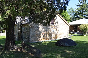
Henry Kendall Cottage at West Gosford
|
|||||||||||||||
| Population | 1,335 (2016 census) | ||||||||||||||
| • Density | 342/km2 (890/sq mi) | ||||||||||||||
| Postcode(s) | 2250 | ||||||||||||||
| Elevation | 10 m (33 ft) | ||||||||||||||
| Area | 3.9 km2 (1.5 sq mi) | ||||||||||||||
| Location | |||||||||||||||
| LGA(s) | Central Coast Council | ||||||||||||||
| Parish | Gosford | ||||||||||||||
| State electorate(s) | Gosford | ||||||||||||||
| Federal Division(s) | Robertson | ||||||||||||||
|
|||||||||||||||
West Gosford is a suburb of the Central Coast region of New South Wales, Australia. It is part of the Central Coast Council local government area. West Gosford is home to the Henry Kendall cottage and was home to the Gosford Classic Car Museum prior to its 2019 closure. While there are some residential areas, West Gosford is known as a retail and industry hub. Bunnings, Spotlight, Anaconda and Officeworks join the Gosford RSL and a Reliance Super Clinic along the Central Coast Highway.
The West Gosford shopping centre, containing Coles supermarket is in Brisbane Water Drive. Primewest's shopping centre is in nearby Manns Road.
Population
In the 2016 Census, there were 1,335 people in West Gosford. 70.8% of people were born in Australia and 82.7% of people spoke only English at home. The most common responses for religion were No Religion 28.6%, Anglican 20.9% and Catholic 20.6%.
Transport
Busways operates five bus routes through the suburb of West Gosford:
- 32: Spencer to Gosford via Mangrove Mountain
- 33: Somersby to Gosford via Kariong and Narara
- 34: Kariong to Gosford
- 55: Ettalong Beach to Gosford via Umina Beach and Woy Woy
- 70: Ettalong Beach to Gosford via Tascott and Point Clare


