Wayside, Kansas facts for kids
Quick facts for kids
Wayside, Kansas
|
|
|---|---|

|
|
| Country | United States |
| State | Kansas |
| County | Montgomery |
| Elevation | 892 ft (272 m) |
| Population
(2020)
|
|
| • Total | 19 |
| Time zone | UTC-6 (CST) |
| • Summer (DST) | UTC-5 (CDT) |
| Area code | 620 |
| FIPS code | 20-76175 |
| GNIS ID | 2804502 |
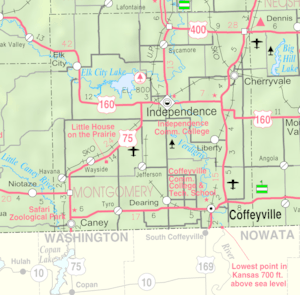
Wayside is a census-designated place (CDP) in Montgomery County, Kansas, United States. As of the 2020 census, the population was 19. It is located along U.S. Route 75 northeast of Caney and southwest of Independence.
Contents
History
A post office was opened in Wayside in 1887, and remained in operation until it was discontinued in 1984.
Wayside is west of the original location of the Little House on the Prairie, the Kansas home of Laura Ingalls Wilder; a reconstruction of the house, along with a museum and relocated period buildings, are located at the site.
Geography
Wayside appears on the Tyro U.S. Geological Survey topographic quadrangle. Montgomery County is in the Central Time Zone (UTC -6 hours).
Demographics
| Historical population | |||
|---|---|---|---|
| Census | Pop. | %± | |
| 2020 | 19 | — | |
| U.S. Decennial Census | |||
Education
The community is served by Caney Valley USD 436 public school district.
Wayside High School was closed through school unification. The Wayside High School mascot was Panthers.


