
Wauzeka, Wisconsin facts for kids
Quick facts for kids
Wauzeka, Wisconsin.
|
|
|---|---|
 |
|

Location of Wauzeka in Crawford County, Wisconsin.
|
|
| Country | |
| State | |
| County | Crawford |
| Area | |
| • Total | 4.84 sq mi (12.53 km2) |
| • Land | 4.82 sq mi (12.49 km2) |
| • Water | 0.02 sq mi (0.04 km2) |
| Elevation | 863 ft (263 m) |
| Population
(2020)
|
|
| • Total | 628 |
| • Density | 130.2/sq mi (50.3/km2) |
| Time zone | UTC-6 (Central (CST)) |
| • Summer (DST) | UTC-5 (CDT) |
| Area code(s) | 608 |
| FIPS code | 55-84725 |
| GNIS feature ID | 1576337 |
Wauzeka is a village in Crawford County, Wisconsin, United States. The population was 628 at the 2020 census. The village is located within the Town of Wauzeka near the confluence of the Kickapoo River and Wisconsin River.
Contents
History
The village of Wauzeka was platted in 1856 by Hercules L. Dousman, with an addition in 1857 by local Mexican–American War veteran John McHarg. It was named after a Native American leader whose Ho-Chunk name, Waaziga, means Pine Tree. The village was connected to the Milwaukee & Mississippi Railroad in 1857 and possessed various sawmills in the nineteenth century to process pine lumber rafted down the Kickapoo River.
Geography
Wauzeka is located at 43°5′6″N 90°53′1″W / 43.08500°N 90.88361°W (43.085232, −90.883614).
According to the United States Census Bureau, the village has a total area of 4.84 square miles (12.54 km2), of which, 4.82 square miles (12.48 km2) of it is land and 0.02 square miles (0.05 km2) is water.

Demographics
| Historical population | |||
|---|---|---|---|
| Census | Pop. | %± | |
| 1900 | 471 | — | |
| 1910 | 476 | 1.1% | |
| 1920 | 479 | 0.6% | |
| 1930 | 519 | 8.4% | |
| 1940 | 513 | −1.2% | |
| 1950 | 564 | 9.9% | |
| 1960 | 494 | −12.4% | |
| 1970 | 437 | −11.5% | |
| 1980 | 580 | 32.7% | |
| 1990 | 595 | 2.6% | |
| 2000 | 768 | 29.1% | |
| 2010 | 711 | −7.4% | |
| 2020 | 628 | −11.7% | |
| U.S. Decennial Census | |||
2020 census
As of the 2020 census, the population was 628. The population density was 130.2 inhabitants per square mile (50.3/km2). There were 305 housing units at an average density of 63.3 per square mile (24.4/km2). The racial makeup of the village was 94.4% White, 0.6% Asian, 0.5% Native American, 0.2% Black or African American, 0.3% from other races, and 4.0% from two or more races. Ethnically, the population was 0.5% Hispanic or Latino of any race.
2010 census
As of the 2010 census there were 711 people, 273 households, and 184 families living in the village. The population density was 147.5 inhabitants per square mile (57.0/km2). There were 304 housing units at an average density of 63.1 per square mile (24.4/km2). The racial makeup of the village was 95.8% White, 1.0% African American, 0.1% Native American, 0.3% Asian, 1.1% from other races, and 1.7% from two or more races. Hispanic or Latino of any race were 1.8% of the population.
There were 273 households, of which 37.0% had children under the age of 18 living with them, 46.9% were married couples living together, 13.9% had a female householder with no husband present, 6.6% had a male householder with no wife present, and 32.6% were non-families. 24.2% of all households were made up of individuals, and 9.9% had someone living alone who was 65 years of age or older. The average household size was 2.60 and the average family size was 3.04.
The median age in the village was 33 years. 28.8% of residents were under the age of 18; 8.1% were between the ages of 18 and 24; 27.5% were from 25 to 44; 26% were from 45 to 64; and 9.6% were 65 years of age or older. The gender makeup of the village was 49.8% male and 50.2% female.
Notable people
- Cyrus L. Lathrop, Wisconsin farmer and legislator, was born in Wauzeka.
- Jeremiah O'Neil, Wisconsin judge and legislator, lived in Wauzeka.
Images for kids
-
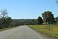
Sign on WIS60
-
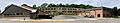
Wauzeka-Steuben Schools
-

Sacred Heart Catholic Church
-
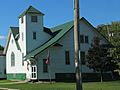
Wauzeka United Methodist Church


See also
 In Spanish: Wauzeka (Wisconsin) para niños
