
Wausaukee, Wisconsin facts for kids
Quick facts for kids
Wausaukee, Wisconsin
|
|
|---|---|

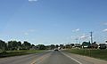
U.S. Route 141 in Wausaukee, Wisconsin
|
|

Location of Wausaukee in Marinette County, Wisconsin.
|
|
| Country | |
| State | |
| County | Marinette |
| Area | |
| • Total | 1.39 sq mi (3.60 km2) |
| • Land | 1.38 sq mi (3.56 km2) |
| • Water | 0.01 sq mi (0.03 km2) |
| Elevation | 774 ft (236 m) |
| Population
(2020)
|
|
| • Total | 596 |
| • Density | 433.1/sq mi (167.2/km2) |
| Time zone | UTC-6 (Central (CST)) |
| • Summer (DST) | UTC-5 (CDT) |
| Area code(s) | 715 & 534 |
| FIPS code | 55-84550 |
| GNIS feature ID | 1576328 |
Wausaukee is a village in Marinette County, Wisconsin, in the United States. The population was 596 at the 2020 census. The village is part of the Marinette, WI–MI Micropolitan Statistical Area.
History
Wausaukee is a Menominee word that means “river in the hills.” The town was started in 1863 by John S. Monroe, who bought 160 acres of land from business tycoon Lars Kovala and built a mill to supply the railroads with lumber for bridges and culverts. His first building was a log cabin home that was also used to board the mill workers. As the town grew and more settlers moved in, his log cabin grew into an inn that was the only public eating establishment north of Green Bay.
On August 19, 2011, at 4:45pm, an EF1 tornado struck Wausaukee. One fatality was recorded.
Geography
Wausaukee is located at 45°23′N 87°57′W / 45.383°N 87.950°W (45.3767, -87.9561).
According to the United States Census Bureau, the village has a total area of 1.39 square miles (3.60 km2), of which, 1.38 square miles (3.57 km2) of it is land and 0.01 square miles (0.03 km2) is water.
The Wausaukee River flows through the village into the Menominee River.
Demographics
| Historical population | |||
|---|---|---|---|
| Census | Pop. | %± | |
| 1930 | 663 | — | |
| 1940 | 655 | −1.2% | |
| 1950 | 612 | −6.6% | |
| 1960 | 608 | −0.7% | |
| 1970 | 557 | −8.4% | |
| 1980 | 648 | 16.3% | |
| 1990 | 656 | 1.2% | |
| 2000 | 572 | −12.8% | |
| 2010 | 575 | 0.5% | |
| 2020 | 596 | 3.7% | |
| U.S. Decennial Census | |||
2010 census
As of the census of 2010, there were 575 people, 275 households, and 145 families living in the village. The population density was 410.7 inhabitants per square mile (158.6/km2). There were 325 housing units at an average density of 232.1 per square mile (89.6/km2). The racial makeup of the village was 95.7% White, 1.2% Native American, 0.2% Asian, 0.5% from other races, and 2.4% from two or more races. Hispanic or Latino of any race were 2.8% of the population.
There were 275 households, of which 25.8% had children under the age of 18 living with them, 33.5% were married couples living together, 12.7% had a female householder with no husband present, 6.5% had a male householder with no wife present, and 47.3% were non-families. 41.8% of all households were made up of individuals, and 24% had someone living alone who was 65 years of age or older. The average household size was 2.09 and the average family size was 2.78.
The median age in the village was 43.3 years. 22.8% of residents were under the age of 18; 7.8% were between the ages of 18 and 24; 21.6% were from 25 to 44; 25.2% were from 45 to 64, and 22.4% were 65 years of age or older. The gender makeup of the village was 48.7% male and 51.3% female.
Notable people
- Trixie Mattel, Folk Singer-Songwriter, Businesswoman, Youtuber, Drag Queen and Comedian
- Harlan P. Bird, Wisconsin State Senator
- Lyle Mays, jazz pianist and composer with the Pat Metheny Group, was born in Wausaukee.
- Zachary A. Vane, Washington State Legislator and businessman
Images for kids
-
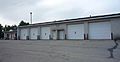
Municipal building and town hall.
-
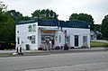
The Ice Cream Station is a seasonally open destination in downtown Wausaukee.
-
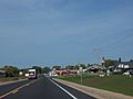
U.S. Route 141 in Wausaukee, Wisconsin
-
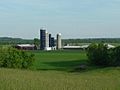
Wausaukee is surrounded by fertile soil and farms.
-

City welcome sign
-
Looking north while entering Wausaukee
-

Post office


See also
 In Spanish: Wausaukee (Wisconsin) para niños
