Waupaca County, Wisconsin facts for kids
Quick facts for kids
Waupaca County
|
|
|---|---|

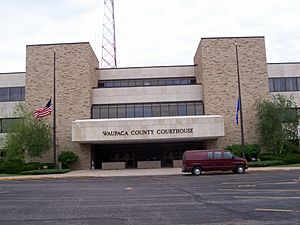
Waupaca County Courthouse
|
|

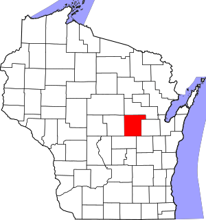
Location within the U.S. state of Wisconsin
|
|
 Wisconsin's location within the U.S. |
|
| Country | |
| State | |
| Founded | 1853 |
| Named for | Chief Waupaca |
| Seat | Waupaca |
| Largest city | New London |
| Area | |
| • Total | 765 sq mi (1,980 km2) |
| • Land | 748 sq mi (1,940 km2) |
| • Water | 17 sq mi (40 km2) 2.3%% |
| Population
(2020)
|
|
| • Total | 51,812 |
| • Estimate
(2023)
|
51,388 |
| • Density | 69.3/sq mi (26.8/km2) |
| Time zone | UTC−6 (Central) |
| • Summer (DST) | UTC−5 (CDT) |
| ZIP Codes |
54981
|
| Congressional district | 8th |
Waupaca County (![]() i/wəˈpækə/ wə-PAK-ə) is a county in the U.S. state of Wisconsin. As of the 2020 census, the population was 51,812. The county seat is Waupaca. The county was created in 1851 and organized in 1853. It is named after the Waupaca River, a Menominee language name meaning 'white sand bottom', 'pale water', or 'tomorrow river'.
i/wəˈpækə/ wə-PAK-ə) is a county in the U.S. state of Wisconsin. As of the 2020 census, the population was 51,812. The county seat is Waupaca. The county was created in 1851 and organized in 1853. It is named after the Waupaca River, a Menominee language name meaning 'white sand bottom', 'pale water', or 'tomorrow river'.
Contents
History
Ancient indigenous peoples constructed earthworks that expressed their religious and political concepts. An early European explorer counted 72 such earthen mounds in what is now Waupaca County, many of them in the form of effigy mounds, shaped like "humans, turtles, catfish and others." There were 52 mounds constructed around what is now called Taylor Lake. Most mounds were lost to agricultural development. One mound, shaped like a catfish, is still visible in a private yard along County Hwy. QQ, just east of Taylor Lake. The site was marked by a local women's club with a commemorative plaque installed on a large stone.
Under pressure from European-American development, the Menominee people ceded their title to the United States for these lands by treaty in 1852. Following that, the flow of new migrant settlers greatly increased from the East, with people moving from New England, New York, and Ohio. They developed the land primarily for agricultural use in the early decades, also quickly establishing sawmills on the rivers.
In the 1870s railroads were constructed in the county: the Wisconsin Central in 1872 and the Green Bay and Minnesota Railroad (later known as Green Bay, Minnesota & St. Paul) in 1873. These improved the county's connections to markets for its lumber and other products. For a period, entrepreneurs and merchants gained high profits from the lumber industry, establishing many fine homes in the larger cities.
Geography
According to the U.S. Census Bureau, the county has a total area of 765 square miles (1,980 km2), of which 748 square miles (1,940 km2) is land and 17 square miles (44 km2) (2.3%) is water. The water includes 22 lakes that form the Waupaca Chain O' Lakes. These lakes are majority spring fed and connected by the Crystal River outlet. Waupaca County is also home to Partridge Lake on the Wolf River and the Waupaca River.
Major highways
Railroads
- Canadian National
- Watco
Airports
- KCLI - Clintonville Municipal Airport
- KPCZ - Waupaca Municipal Airport
Adjacent counties
- Shawano County - north
- Outagamie County - east
- Winnebago County - southeast
- Waushara County - southwest
- Portage County - west
- Marathon County - northwest
Demographics
| Historical population | |||
|---|---|---|---|
| Census | Pop. | %± | |
| 1860 | 8,851 | — | |
| 1870 | 15,539 | 75.6% | |
| 1880 | 20,955 | 34.9% | |
| 1890 | 26,794 | 27.9% | |
| 1900 | 31,615 | 18.0% | |
| 1910 | 32,782 | 3.7% | |
| 1920 | 34,200 | 4.3% | |
| 1930 | 33,513 | −2.0% | |
| 1940 | 34,614 | 3.3% | |
| 1950 | 35,056 | 1.3% | |
| 1960 | 35,340 | 0.8% | |
| 1970 | 37,780 | 6.9% | |
| 1980 | 42,831 | 13.4% | |
| 1990 | 46,104 | 7.6% | |
| 2000 | 51,731 | 12.2% | |
| 2010 | 52,410 | 1.3% | |
| 2020 | 51,812 | −1.1% | |
| U.S. Decennial Census 1790–1960 1900–1990 1990–2000 2010–2020 |
|||
2020 census
As of the census of 2020, the population was 51,812. The population density was 69.3 people per square mile (26.8 people/km2). There were 25,457 housing units at an average density of 34.0 units per square mile (13.1 units/km2). The racial makeup of the county was 93.2% White, 0.6% Native American, 0.5% Asian, 0.4% Black or African American, 1.6% from other races, and 3.7% from two or more races. Ethnically, the population was 3.6% Hispanic or Latino of any race.
Communities
Cities
- Clintonville
- Manawa
- Marion (partly in Shawano County)
- New London (partly in Outagamie County)
- Waupaca (county seat)
- Weyauwega
Villages
Towns
Census-designated places
Unincorporated communities
Ghost towns/neighborhoods
See also
 In Spanish: Condado de Waupaca para niños


