Washburn County, Wisconsin facts for kids
Quick facts for kids
Washburn County
|
|
|---|---|

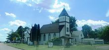
Historical Museum in Shell Lake, Wisconsin
|
|

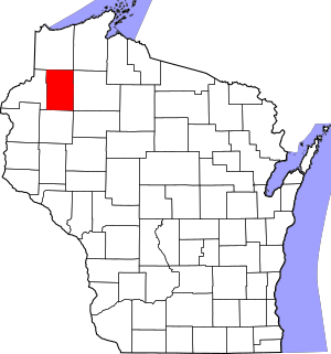
Location within the U.S. state of Wisconsin
|
|
 Wisconsin's location within the U.S. |
|
| Country | |
| State | |
| Founded | 1883 |
| Named for | Cadwallader C. Washburn |
| Seat | Shell Lake |
| Largest city | Spooner |
| Area | |
| • Total | 853 sq mi (2,210 km2) |
| • Land | 797 sq mi (2,060 km2) |
| • Water | 56 sq mi (150 km2) 6.6%% |
| Population
(2020)
|
|
| • Total | 16,623 |
| • Estimate
(2023)
|
16,930 |
| • Density | 20.9/sq mi (8.1/km2) |
| Time zone | UTC−6 (Central) |
| • Summer (DST) | UTC−5 (CDT) |
| Congressional district | 7th |
Washburn County is a county in the U.S. state of Wisconsin. It is named after Governor Cadwallader C. Washburn. As of the 2020 census, the population was 16,623. Its county seat is Shell Lake. The county was created in 1883.
Contents
Geography
According to the U.S. Census Bureau, the county has a total area of 853 square miles (2,210 km2), of which 797 square miles (2,060 km2) is land and 56 square miles (150 km2) (6.6%) is water.
Major highways
 U.S. Highway 53
 U.S. Highway 63
 Highway 48 (Wisconsin)
 Highway 70 (Wisconsin)
 Highway 77 (Wisconsin)
 Highway 253 (Wisconsin)
Railroads
Airport
Shell Lake Municipal Airport (KSSQ) serves the county and surrounding communities.
Adjacent counties
- Douglas County - north
- Bayfield County - northeast
- Sawyer County - east
- Rusk County - southeast
- Barron County - south
- Burnett County - west
National protected area
Demographics
| Historical population | |||
|---|---|---|---|
| Census | Pop. | %± | |
| 1890 | 2,926 | — | |
| 1900 | 5,521 | 88.7% | |
| 1910 | 8,196 | 48.5% | |
| 1920 | 11,377 | 38.8% | |
| 1930 | 11,103 | −2.4% | |
| 1940 | 12,496 | 12.5% | |
| 1950 | 11,665 | −6.7% | |
| 1960 | 10,301 | −11.7% | |
| 1970 | 10,601 | 2.9% | |
| 1980 | 13,174 | 24.3% | |
| 1990 | 13,772 | 4.5% | |
| 2000 | 16,036 | 16.4% | |
| 2010 | 15,911 | −0.8% | |
| 2020 | 16,623 | 4.5% | |
| U.S. Decennial Census 1790–1960 1900–1990 1990–2000 2010 2020 |
|||
2020 census
As of the census of 2020, the population was 16,623. The population density was 20.9 people per square mile (8.1 people/km2). There were 12,708 housing units at an average density of 15.9 units per square mile (6.1 units/km2). The racial makeup of the county was 92.9% White, 1.2% Native American, 0.4% Asian, 0.2% Black or African American, 0.1% Pacific Islander, 0.5% from other races, and 4.8% from two or more races. Ethnically, the population was 1.8% Hispanic or Latino of any race.
Communities
Cities
- Shell Lake (county seat)
- Spooner
Villages
Towns
Census-designated places
- Springbrook
- Stone Lake (part)
- Trego
Other unincorporated communities
Ghost towns
Education
School districts include:
- Birchwood School District
- Hayward Community School District
- Northwood School District
- Rice Lake Area School District
- Shell Lake School District
- Spooner Area School District
In 1918, the loss of the SS Tuscania prompted the county to burn its German textbooks as part of anti-German sentiment in World War I.
See also
 In Spanish: Condado de Washburn para niños


