Waikolu, Hawaii facts for kids
Quick facts for kids
Waikolu
|
|
|---|---|
| Country | United States |
| State | Hawaii |
| County | Maui / Kalawao |
| Area | |
| • Total | 5.544 sq mi (14.359 km2) |
| Elevation | 1,581 ft (482 m) |
| Population
(2000)
|
|
| • Total | 1 |
| • Density | 0.18/sq mi (0.07/km2) |
| Time zone | UTC-10 (Hawaii-Aleutian) |
| GNIS feature ID | 364703 |
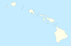
Waikolu Valley, also called Waikola, is on the North Shore of Molokai in Hawaii. Access to this uninhabited valley is currently restricted as it is a partly within the Kalaupapa National Historical Park.
History
Hawaiians lived along the North Shore of Molokai including Waikolu Valley, cultivating taro and other food crops. These isolated valleys were visited in the summer months when the weather is calmer; in winter, heavy surf renders the beaches inaccessible by outrigger canoe, the islanders' chief form of transportation.
The Native Hawaiian inhabitants were removed in 1865 and 1866 when the leper colony was established on the Kalaupapa Peninsula. Waikolu Valley was where the first leprosy patients were off loaded in 1866. However, the valley was soon abandoned, and the colony was established at Kalawao nearby.


