Vromos Island facts for kids

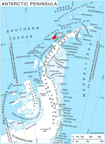
Location of Anvers Island in the Antarctic Peninsula region.
|
|
| Geography | |
|---|---|
| Location | Antarctica |
| Coordinates | 64°24′55″S 63°41′36″W / 64.41528°S 63.69333°W |
| Archipelago | Palmer Archipelago |
| Administration | |
| Administered under the Antarctic Treaty System | |
| Demographics | |
| Population | 0 |
Vromos Island (Bulgarian: остров Вромос, romanized: ostrov Vromos) is a rocky island 600 m long in east-west direction and 260 m wide lying in Perrier Bay on the northwest coast of Anvers Island in the Palmer Archipelago, Antarctica. It is separated from Trebishte Island to the south by a 300 m wide passage.
The island is named after Vromos Bay on the Bulgarian Black Sea Coast.
Location
Vromos Island is located at 64°24′55″S 63°41′36″W / 64.41528°S 63.69333°W, 5.07 km east-northeast of Giard Point, 5.21 km south of Masteyra Island and 11.45 km south of Quinton Point. British mapping in 1980.
Maps

All content from Kiddle encyclopedia articles (including the article images and facts) can be freely used under Attribution-ShareAlike license, unless stated otherwise. Cite this article:
Vromos Island Facts for Kids. Kiddle Encyclopedia.