Vendôme facts for kids
Quick facts for kids
Vendôme
|
||
|---|---|---|
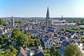
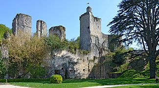
A general view of the centre of Vendôme.
|
||
|
||
| Country | France | |
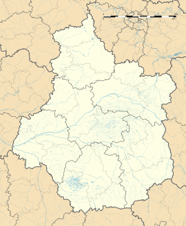
| Region | Centre-Val de Loire | |
| Department | Loir-et-Cher | |
| Arrondissement | Vendôme | |
| Canton | Vendôme | |
| Intercommunality | Territoires Vendômois | |
| Area
1
|
23.89 km2 (9.22 sq mi) | |
| Population
(2014)
|
16,879 | |
| • Density | 706.53/km2 (1,829.9/sq mi) | |
| Demonym(s) | Vendômois | |
| Time zone | UTC+01:00 (CET) | |
| • Summer (DST) | UTC+02:00 (CEST) | |
| INSEE/Postal code |
41269 /41100
|
|
| Elevation | 76–141 m (249–463 ft) (avg. 109 m or 358 ft) |
|
| Website | Official website: http://www.vendome.eu/ | |
| 1 French Land Register data, which excludes lakes, ponds, glaciers > 1 km2 (0.386 sq mi or 247 acres) and river estuaries. | ||
Vendôme is a commune in central French, and is a subprefecture in the Loir-et-Cher department. It is also the capital of the arrrondissement of Vendôme and the administrative centre of the Vendôme canton.
Vendôme is one of the main towns along the Loir river. It is the third largest city of the department after Blois and Romorantin-Lanthenay.
Contents
Geography
The city of Vendôme is along the Loir river. The commune has an area of 23.9 km2 (9.2 sq mi). Its average altitude is 109 m (358 ft); at the city hall, the altitude is 80 m (260 ft).
The distances from Chinon to other cities are:
- Paris, the national capital - 175 km (109 mi);
- Blois, the departmental capital - 35 km (22 mi);
- Orléans - the regional capital 91 km (57 mi);
- Reims - 310 km (190 mi);
- Bordeaux - 410 km (250 mi);
- Toulouse - 548 km (341 mi);
- Montpellier - 648 km (403 mi);
- Lyon - 472 km (293 mi);
- Nantes - 282 km (175 mi);
- Marseille - 782 km (486 mi).
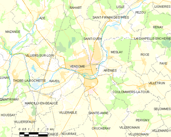 |
The commune of Vendôme is surrounded by the communes:
 |
Naveil | Saint-Ouen | Saint-Ouen |  |
| Naveil | Saint-Ouen | |||
| Villerable | Sainte-Anne | Sainte-Anne |
Climate
The Köppen climate classification type for the climate at Vendôme is an "Oceanic climate" (also known as Marine West Coast Climate) and of the subtype Cfb.
The average amount of precipitation for the year in Vendôme is 604.5 mm (23.8 in). The month with the most precipitation on average is October with 58.4 mm (2.3 in) of precipitation. The month with the least precipitation on average is February with an average of 40.6 mm (1.6 in).
The average temperature for the year in Vendôme is 10 °C (50 °F). The warmest month, on average, is July with an average temperature of 18.9 °C (66.0 °F). The coolest month on average is January, with an average temperature of 35.0 °C (95.0 °F).
| Climate data for Vendôme, France | |||||||||||||
|---|---|---|---|---|---|---|---|---|---|---|---|---|---|
| Month | Jan | Feb | Mar | Apr | May | Jun | Jul | Aug | Sep | Oct | Nov | Dec | Year |
| Daily mean °C (°F) | 2 (36) |
4 (39) |
7 (45) |
10 (50) |
13 (55) |
17 (63) |
19 (66) |
18 (64) |
15 (59) |
11 (52) |
6 (43) |
3 (37) |
10 (51) |
| Average rainfall mm (inches) | 49 (1.9) |
41 (1.6) |
44 (1.7) |
45 (1.8) |
55 (2.2) |
54 (2.1) |
50 (2.0) |
48 (1.9) |
48 (1.9) |
59 (2.3) |
59 (2.3) |
54 (2.1) |
606 (23.8) |
| Source: Weatherbase.com [1] | |||||||||||||
Population
The inhabitants of Vendôme are known, in French, as Vendômois (women: Vendômoises).
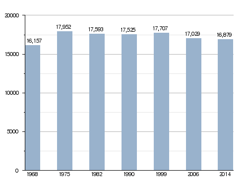
With a population of 16,879, Vendôme has a population density of 707 inhabitants/km2.
Evolution of the population in Vendôme
Administration
Vendôme is a subprefecture of the Loir-et-Cher department, the capital of the arrondissement of Vendôme and the administrative centre (French: chef-lieu) of the canton of Vendôme, with 24,663 inhabitants (2014).
It is part of the intercommunality Territoires Vendômois (French: Communauté d'agglomération Territoires Vendômois).
Twinned and partner towns
Vendôme is twinned with:
 Gevelsberg, Germany, since 1965
Gallery

-
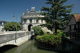
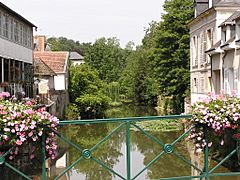
The Loir river in Vendôme.
Related pages
Images for kids
See also
 In Spanish: Vendôme para niños


