Vaz/Obervaz facts for kids
Quick facts for kids
Vaz/Obervaz
|
||
|---|---|---|
|
||
| Country | Switzerland | |
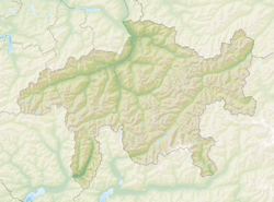
| Canton | Graubünden | |
| District | Albula | |
| Area | ||
| • Total | 42.51 km2 (16.41 sq mi) | |
| Elevation | 1,476 m (4,843 ft) | |
| Highest elevation
(Parpaner Rothorn)
|
2,865 m (9,400 ft) | |
| Lowest elevation
(Schin gorge)
|
700 m (2,300 ft) | |
| Population
(Dec 2020 )
|
||
| • Total | 2,802 | |
| • Density | 65.914/km2 (170.72/sq mi) | |
| Postal code |
7082
|
|
| Localities | Lenzerheide, Valbella, Lain, Muldain, Zorten, Nivaigl, Fuso, Trantermoira, Sporz, Tgantieni, Sartons, Creusen, Obersolis | |
| Surrounded by | Almens, Alvaschein, Arosa, Churwalden, Lantsch/Lenz, Mutten, Parpan, Scharans, Sils im Domleschg, Stierva, Tschiertschen | |
Vaz/Obervaz is a municipality of the canton of Graubünden in Switzerland.
Villages
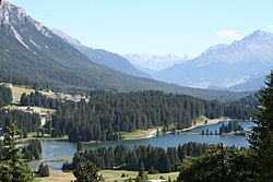
Lenzerheide, Valbella, Lain, Muldain, Zorten, Nivaigl, Fuso, Trantermoira, Sporz, Tgantieni, Sartons, Creusen, and Obersolis.
Images for kids
See also
 In Spanish: Vaz/Obervaz para niños

All content from Kiddle encyclopedia articles (including the article images and facts) can be freely used under Attribution-ShareAlike license, unless stated otherwise. Cite this article:
Vaz/Obervaz Facts for Kids. Kiddle Encyclopedia.


