Vandalia, Indiana facts for kids
Quick facts for kids
Vandalia, Indiana
|
|
|---|---|

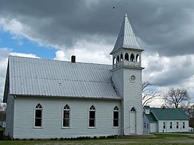
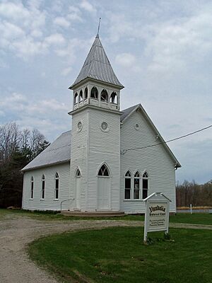
Vandalia, Indiana Historic Chapel & School
|
|
| Country | United States |
| State | Indiana |
| County | Owen |
| Township | Lafayette |
| Elevation | 787 ft (240 m) |
| Time zone | UTC-5 (Eastern (EST)) |
| • Summer (DST) | UTC-4 (EDT) |
| ZIP code |
47868
|
| Area code(s) | 812, 930 |
| GNIS feature ID | 445224 |
Vandalia is an unincorporated community in Lafayette Township, Owen County, in the U.S. state of Indiana.
History
Vandalia was laid out in 1839. A post office was established at Vandalia in 1846, and remained in operation until it was discontinued in 1927. Two remaining landmarks and reminders of Vandalia's past are the historic chapel (built in 1895) and one-room schoolhouse (building completed in 1868), preserved and maintained by the Vandalia Community Preservation Association.
Geography
Vandalia is located at 39°18′45″N 86°51′58″W / 39.31250°N 86.86611°W at an elevation of 787 feet. It lies at the east end of State Road 246 where it intersects State Road 46. The main village originated near coordinates 39.3137257,-86.8679851.

All content from Kiddle encyclopedia articles (including the article images and facts) can be freely used under Attribution-ShareAlike license, unless stated otherwise. Cite this article:
Vandalia, Indiana Facts for Kids. Kiddle Encyclopedia.


