Vale, Avery County, North Carolina facts for kids
Quick facts for kids
Vale
|
|
|---|---|
| Country | United States |
| State | North Carolina |
| County | Avery County |
| Elevation | 3,550 ft (1,082 m) |
| Time zone | UTC-5 (Eastern (EST)) |
| • Summer (DST) | UTC-4 (EDT) |
| ZIP code |
28657
|
| Area code(s) | 828 |
| GNIS feature ID | 1023058 |
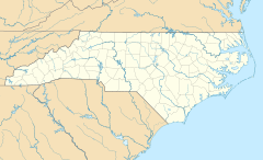
Vale is an unincorporated community in Avery County, North Carolina, United States. It is located northwest of Newland on Old Toe River Road.
History
From 1904 to 1940, Vale was a flag stop along the East Tennessee and Western North Carolina Railroad; between Minneapolis and Newland. Old Toe River Road now resides on what was the old railway path.

All content from Kiddle encyclopedia articles (including the article images and facts) can be freely used under Attribution-ShareAlike license, unless stated otherwise. Cite this article:
Vale, Avery County, North Carolina Facts for Kids. Kiddle Encyclopedia.

