Uriarra, New South Wales facts for kids
Quick facts for kids UriarraNew South Wales |
|||||||||||||||
|---|---|---|---|---|---|---|---|---|---|---|---|---|---|---|---|
 |
|||||||||||||||
| Population | 30 (2016 census) | ||||||||||||||
| Postcode(s) | 2611 | ||||||||||||||
| LGA(s) | Yass Valley Council | ||||||||||||||
| County | Cowley | ||||||||||||||
| Parish |
|
||||||||||||||
| State electorate(s) | Goulburn | ||||||||||||||
| Federal Division(s) | Eden-Monaro | ||||||||||||||
|
|||||||||||||||
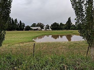
Uriarra is a locality in the Southern Tablelands of New South Wales, Australia in the Yass Valley Shire. It is north of the locality of Uriarra in the Australian Capital Territory and north-west of Canberra. At the 2016 census, it had a population of 30. The locality is mostly located in the Urayarra parish of Cowley County, although part of it in Pabral parish, which lies further west.

All content from Kiddle encyclopedia articles (including the article images and facts) can be freely used under Attribution-ShareAlike license, unless stated otherwise. Cite this article:
Uriarra, New South Wales Facts for Kids. Kiddle Encyclopedia.

