Toombs County, Georgia facts for kids
Quick facts for kids
Toombs County
|
|
|---|---|

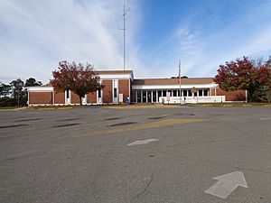
Former Toombs County Courthouse in Lyons
|
|

Location within the U.S. state of Georgia
|
|
 Georgia's location within the U.S. |
|
| Country | |
| State | |
| Founded | August 18, 1905 |
| Named for | Robert Toombs |
| Seat | Lyons |
| Largest city | Vidalia |
| Area | |
| • Total | 371 sq mi (960 km2) |
| • Land | 364 sq mi (940 km2) |
| • Water | 7.0 sq mi (18 km2) 1.9%% |
| Population
(2020)
|
|
| • Total | 27,030 |
| • Density | 74/sq mi (29/km2) |
| Time zone | UTC−5 (Eastern) |
| • Summer (DST) | UTC−4 (EDT) |
| Congressional district | 12th |
Toombs County is a county located in the east central portion of the U.S. state of Georgia. As of the 2020 census, the population was 27,030. The county seat is Lyons and the largest city is Vidalia. The county was created on August 18, 1905.
Toombs County is part of the Vidalia micropolitan statistical area.
Contents
History
Toombs County was founded as the 144th county in Georgia by the State Legislature on August 18, 1905, and organized on October 9 of that year. The county was originally formed from portions of Tattnall and Montgomery Counties; a small piece of Emanuel County was added in 1907 to give Toombs County its present-day boundaries.
The county is named for Robert Toombs, United States representative and senator. During the Civil War, Toombs also served in the Confederate Provisional Congress, as Secretary of State of the Confederate States, and a brigadier general in the Confederate Army.
Geography
According to the U.S. Census Bureau, the county has a total area of 371 square miles (960 km2), of which 364 square miles (940 km2) is land and 7.0 square miles (18 km2) (1.9%) is water.
The southern half of Toombs County, from south of Vidalia southeast to State Route 147, is located in the Altamaha River sub-basin of the larger river basin by the same name. The northern half of the county, centered on Lyons, is located in the Ohoopee River sub-basin of the Altamaha River basin.
Major highways
 U.S. Route 1
 U.S. Route 280
 State Route 4
 State Route 15
 State Route 29
 State Route 30
 State Route 56
 State Route 86
 State Route 130
 State Route 147
 State Route 152
 State Route 178
 State Route 292
 State Route 297
 State Route 298
Adjacent counties
- Emanuel County (north)
- Tattnall County (east)
- Appling County (south)
- Jeff Davis County (southwest)
- Montgomery County (west)
- Treutlen County (northwest)
- Candler County (northeast)
Communities
Cities
Census-designated place
- Ohoopee
Demographics
| Historical population | |||
|---|---|---|---|
| Census | Pop. | %± | |
| 1910 | 11,206 | — | |
| 1920 | 13,897 | 24.0% | |
| 1930 | 17,165 | 23.5% | |
| 1940 | 16,952 | −1.2% | |
| 1950 | 17,382 | 2.5% | |
| 1960 | 16,837 | −3.1% | |
| 1970 | 19,151 | 13.7% | |
| 1980 | 22,592 | 18.0% | |
| 1990 | 24,072 | 6.6% | |
| 2000 | 26,067 | 8.3% | |
| 2010 | 27,223 | 4.4% | |
| 2020 | 27,030 | −0.7% | |
| 2023 (est.) | 27,040 | −0.7% | |
| U.S. Decennial Census 1790-1880 1890-1910 1920-1930 1930-1940 1940-1950 1960-1980 1980-2000 2010 |
|||
| Race | Num. | Perc. |
|---|---|---|
| White (non-Hispanic) | 16,007 | 59.22% |
| Black or African American (non-Hispanic) | 6,980 | 25.82% |
| Native American | 31 | 0.11% |
| Asian | 207 | 0.77% |
| Pacific Islander | 6 | 0.02% |
| Other/Mixed | 755 | 2.79% |
| Hispanic or Latino | 3,044 | 11.26% |
As of the 2020 United States census, there were 27,030 people, 10,030 households, and 6,537 families residing in the county.
Notable people
- Mel Blount (football hall of famer and founder of Mel Blount Youth Home)
- Nick Eason (former NFL player and current NFL assistant defensive line coach)
- Craig Campbell (country music singer)
- Fred Stokes (former pro football player)
- Travares Tillman (professional football player)
- Don Collins (former professional baseball player)
- Paul Claxton (PGA tour professional golfer)
- Wally Moses (former professional baseball player)
- Algur H. Meadows (oilman, businessman)
- Iris Blitch (politician)
- Carl Simpson (former professional baseball player)
- Don Harris (journalist killed during Jonestown Massacre)
- Ben Utt (professional football player)
- Paul Anderson (strongest man)
See also
 In Spanish: Condado de Toombs para niños

