Thompsonville, Jim Hogg County, Texas facts for kids
Quick facts for kids
Thompsonville,
Jim Hogg County, Texas |
|
|---|---|
| Country | United States |
| State | Texas |
| County | Jim Hogg |
| Area | |
| • Total | 3.9 sq mi (10.1 km2) |
| • Land | 3.9 sq mi (10.1 km2) |
| • Water | 0 sq mi (0.0 km2) |
| Elevation | 669 ft (204 m) |
| Population
(2010)
|
|
| • Total | 46 |
| • Density | 12/sq mi (4.6/km2) |
| Time zone | UTC-6 (Central (CST)) |
| • Summer (DST) | UTC-5 (CDT) |
| FIPS code | 48-72758 |
| GNIS feature ID | 2584746 |
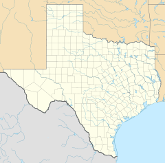
Thompsonville is a census-designated place (CDP) and unincorporated community in Jim Hogg County, Texas, United States. The population of the CDP was 46 at the 2010 census. The CDP is located along Farm to Market Road 3073 in northwestern Jim Hogg County, 9 miles (14 km) southwest of Hebbronville, the county seat.
Contents
Etymology
The CDP takes its name from an unincorporated community near the western border of Jim Hogg County, at the junction of Farm Roads 649 and 3073, 9 miles (14 km) west of the Thompsonville CDP and 18 miles (29 km) southwest of Hebbronville. According to the Handbook of Texas, the community was probably named after Jim Hogg County's first sheriff, Oscar Thompson.
History
Thompsonville's history dates back to the 1910s. The first commercial oil well in the county began producing oil on April 17, 1921. The well was located in the Mirando Valley field near Thompsonville and brought new residents to the area. A post office in 1925, but was discontinued around 1936. A school and several businesses were located at the site in the late 1940s. Today, Thompsonville is a small, dispersed community with a population less than 50.
Demographics
| Historical population | |||
|---|---|---|---|
| Census | Pop. | %± | |
| 2010 | 46 | — | |
| U.S. Decennial Census 1850–1900 1910 1920 1930 1940 1950 1960 1970 1980 1990 2000 2010 |
|||
See also
 In Spanish: Thompsonville (Texas) para niños


