The Hammocks, Florida facts for kids
Quick facts for kids
The Hammocks
|
|
|---|---|

Location in Miami-Dade County and the state of Florida
|
|

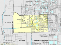
U.S. Census Bureau map showing CDP boundaries
|
|
| Country | |
| State | |
| County | |
| Area | |
| • Census-designated place | 8.10 sq mi (20.98 km2) |
| • Land | 7.89 sq mi (20.43 km2) |
| • Water | 0.21 sq mi (0.55 km2) |
| • Metro | 6,137 sq mi (15,890 km2) |
| Elevation | 8 ft (2 m) |
| Population
(2020)
|
|
| • Census-designated place | 59,480 |
| • Density | 7,540.57/sq mi (2,911.43/km2) |
| Time zone | UTC-5 (EST) |
| • Summer (DST) | UTC-4 (EDT) |
| ZIP codes |
33186, 33196 (Miami)
|
| Area code(s) | 305, 786, 645 |
| FIPS code | 12-71569 |
| GNIS feature ID | 1853293 |
The Hammocks is a planned community and census-designated place in Miami-Dade County, Florida, United States. It is part of the Miami metropolitan area of South Florida. The population was 59,480 at the 2020 census, up from 51,003 in 2010.
Contents
Geography
The Hammocks is located at 25°40′14″N 80°26′10″W / 25.67056°N 80.43611°W (25.670601, -80.436006); or about 6 miles (10 km) west of Kendall and 18 miles (29 km) southwest of downtown Miami.
The CDP and planned community encompass the area west of SW 137th Avenue, south of SW 88th Street, east of SW 177 Ave, and north of SW 120th St. It is bordered to the east by The Crossings and to the north by Kendall West and Kendale Lakes.
According to the United States Census Bureau, the CDP has a total area of 8.1 square miles (21 km2), of which 7.9 square miles (20 km2) are land and 0.2 square miles (0.52 km2), or 2.64%, are water.
Demographics
| Historical population | |||
|---|---|---|---|
| Census | Pop. | %± | |
| 1990 | 10,897 | — | |
| 2000 | 47,379 | 334.8% | |
| 2010 | 51,003 | 7.6% | |
| 2020 | 59,480 | 16.6% | |
| source: | |||
2020 census
| Race / Ethnicity (NH = Non-Hispanic) | Pop 2010 | Pop 2020 | % 2010 | % 2020 |
|---|---|---|---|---|
| White (NH) | 7,119 | 5,846 | 13.96% | 9.83% |
| Black or African American (NH) | 2,430 | 2,036 | 4.76% | 3.42% |
| Native American or Alaska Native (NH) | 40 | 41 | 0.08% | 0.07% |
| Asian (NH) | 1,499 | 1,718 | 2.94% | 2.89% |
| Pacific Islander or Native Hawaiian (NH) | 7 | 8 | 0.01% | 0.01% |
| Some other race (NH) | 124 | 343 | 0.24% | 0.58% |
| Mixed race or Multiracial (NH) | 540 | 1,001 | 1.06% | 1.68% |
| Hispanic or Latino (any race) | 39,244 | 48,487 | 76.94% | 81.52% |
| Total | 51,003 | 59,480 | 100.00% | 100.00% |
As of the 2020 United States census, there were 59,480 people, 17,877 households, and 14,943 families residing in the CDP.
As of the 2010 United States census, there were 51,003 people, 15,967 households, and 12,620 families residing in the CDP.
Economy

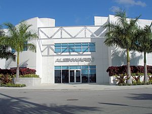
The headquarters for Alienware is located in The Hammocks.
Education
Public education in The Hammocks is serviced by the Miami-Dade County Public Schools system.
Elementary schools
- Claude Pepper Elementary School
- Gilbert L. Porter Elementary School
- Oliver Hoover Elementary School
- Christina M. Eve Elementary School
Middle school
- Hammocks Middle School
High school
- Felix Varela High School
Private school
- Archbishop Coleman F. Carroll High School
- Our Lady of Lourdes Parish School - Established in 1997.
See also
 In Spanish: The Hammocks para niños

