Tehran Province facts for kids
Quick facts for kids
Tehran Province
استان تهران
|
|
|---|---|

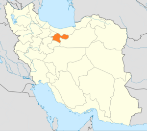
Location of Tehran within Iran
|
|
| Country | |
| Capital | Tehran |
| Counties | 13 |
| Area | |
| • Total | 18,814 km2 (7,264 sq mi) |
| Population
(2005)
|
|
| • Total | 12,150,742 |
| • Density | 645.835/km2 (1,672.71/sq mi) |
| Time zone | UTC+03:30 (IRST) |
| • Summer (DST) | UTC+04:30 (IRDT) |
| Main language(s) | Persian |
Tehran Province (Persian: استان تهران;) is one of the 30 provinces of Iran. It has an area of 18,909 square kilometers. It can be found to the north of the center plateau in Iran. As of June 2005, this province contains 13 townships, 43 municipalities, and 1,358 villages.
Counties and municipalities
Counties
Municipalities
Absard, Andishe, Baghershahr, Baghestan, Boumehen, Chahardangeh, Damavand, Eshtehard, Eslamshahr, Ferdowsieh, Firouzkouh, Garmdarreh, Gharchak, Ghods, Golestan, Shahriar, Hashtgerd, Hashtgerd New City, Javadabad, Hassan Abad, Kahrizak, Kamalshahr, Karaj, Kilan, Lavasan, Mahdasht, Malard, Meshkindasht, Mohammadshahr, Nasimshahr, Nazarbad, Owshan Fasham Meygoun, Pakdasht, Pardis, Pishva, Robat Karim, Roudehen, Sabasharh, Safadasht, Shahedshahr, Shahriar, Sharifabad, Tehran, Vahidieh, Varamin,
Images for kids
-
Tehran has been Iran's capital since 1778.
-
The Achaemenid collection of The National Museum of Iran in Tehran.
-
A view of Tehran and Alborz Mountains
-
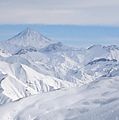
View of Mount Damavand (itself located in Mazandaran province) as seen from the Dizin ski resort.
See also
 In Spanish: Provincia de Teherán para niños


