Summit, Oregon facts for kids
Quick facts for kids
Summit
|
|
|---|---|

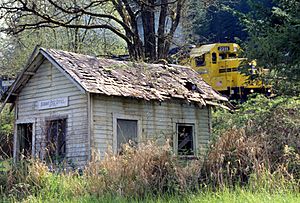
A train passing by Summit's former post office
|
|
| State | |
| Area | |
| • Total | 0.32 sq mi (0.83 km2) |
| • Land | 0.32 sq mi (0.83 km2) |
| • Water | 0.00 sq mi (0.00 km2) |
| Elevation | 718 ft (219 m) |
| Population
(2020)
|
|
| • Total | 72 |
| • Density | 225.71/sq mi (87.12/km2) |
| Time zone | UTC-8 (Pacific (PST)) |
| • Summer (DST) | UTC-7 (PDT) |
| ZIP code |
97326
|
| Area code(s) | 458 and 541 |
| FIPS code | 41-70870 |
Summit is an unincorporated community and census-designated place in Benton County, Oregon, United States. At the 2010 census, it had a population of 82. Summit lies on Oregon Route 180 northwest of Blodgett. Summit has an elevation of 718 feet (219 m).
Since 1980 Summit is known locally for its small Summit Summer Festival on the third Saturday in August. At the Hippie-style gathering with food and music artisans offer their products, e.g. hand made knives, quilts; artists make their shows e.g. big soap bubbles and visitors get involved.
Demographics
| Historical population | |||
|---|---|---|---|
| Census | Pop. | %± | |
| 2020 | 72 | — | |
| U.S. Decennial Census | |||
See also
 In Spanish: Summit (Oregón) para niños

All content from Kiddle encyclopedia articles (including the article images and facts) can be freely used under Attribution-ShareAlike license, unless stated otherwise. Cite this article:
Summit, Oregon Facts for Kids. Kiddle Encyclopedia.

